You are here: Home > Network List > IU - Global Seismograph Network (GSN - IRIS/USGS) Stations List
> Station PMSA Palmer Station, Antarctica > Earthquake Result Viewer
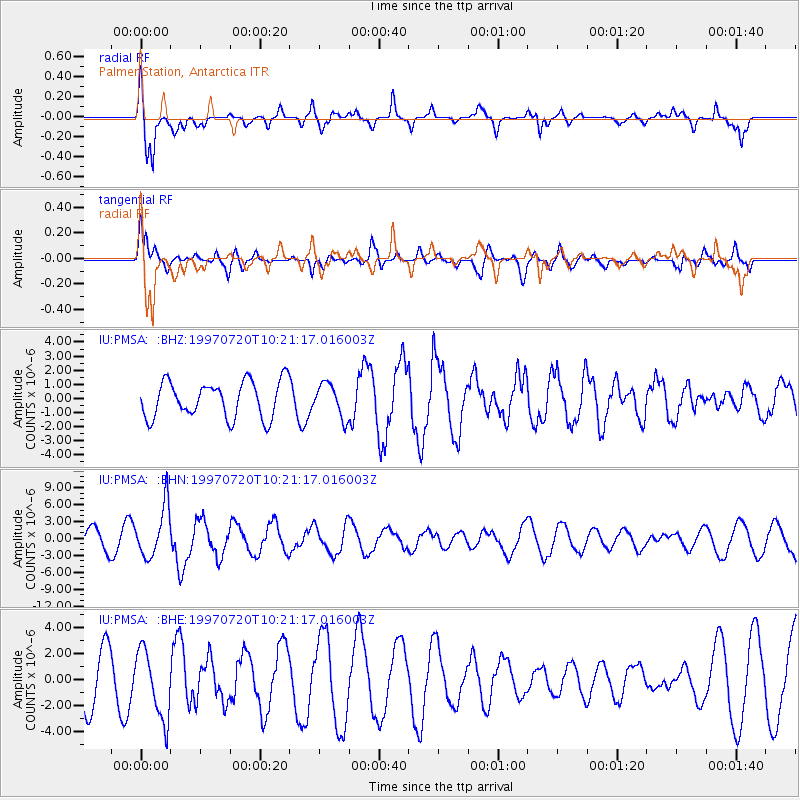
PMSA Palmer Station, Antarctica - Earthquake Result Viewer
*The percent match for this event was below the threshold and hence no stack was calculated.
| Earthquake location: |
Jujuy Province, Argentina |
| Earthquake latitude/longitude: |
-23.0/-66.3 |
| Earthquake time(UTC): |
1997/07/20 (201) 10:14:22 GMT |
| Earthquake Depth: |
256 km |
| Earthquake Magnitude: |
5.7 MB, 6.1 UNKNOWN, 5.7 ME |
| Earthquake Catalog/Contributor: |
WHDF/NEIC |
|
| Network: |
IU Global Seismograph Network (GSN - IRIS/USGS) |
| Station: |
PMSA Palmer Station, Antarctica |
| Lat/Lon: |
64.77 S/64.05 W |
| Elevation: |
40 m |
|
| Distance: |
41.8 deg |
| Az: |
178.553 deg |
| Baz: |
356.886 deg |
| Ray Param: |
$rayparam |
*The percent match for this event was below the threshold and hence was not used in the summary stack. |
|
| Radial Match: |
83.69035 % |
| Radial Bump: |
400 |
| Transverse Match: |
56.713783 % |
| Transverse Bump: |
400 |
| SOD ConfigId: |
4480 |
| Insert Time: |
2010-03-04 15:30:40.381 +0000 |
| GWidth: |
2.5 |
| Max Bumps: |
400 |
| Tol: |
0.001 |
|
Signal To Noise
| Channel | StoN | STA | LTA |
| IU:PMSA: :BHN:19970720T10:21:17.016003Z | 3.3087857 | 4.513372E-6 | 1.3640569E-6 |
| IU:PMSA: :BHE:19970720T10:21:17.016003Z | 1.6051189 | 2.6212208E-6 | 1.6330386E-6 |
| IU:PMSA: :BHZ:19970720T10:21:17.016003Z | 0.92705923 | 1.1949569E-6 | 1.2889758E-6 |
| Arrivals |
| Ps | |
| PpPs | |
| PsPs/PpSs | |


