TSUM Tsumeb, Namibia - Earthquake Result Viewer
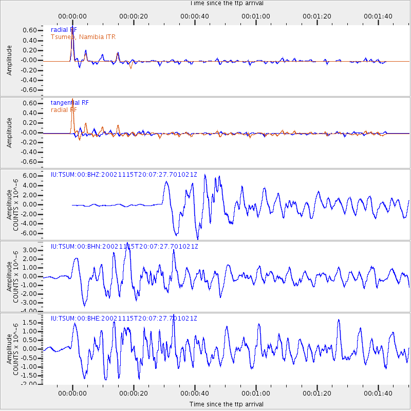
Earthquake location: South Georgia Island Region
Earthquake latitude/longitude: -56.1/-36.4
Earthquake time(UTC): 2002/11/15 (319) 19:58:31 GMT
Earthquake Depth: 10 km
Earthquake Magnitude: 6.1 MB, 6.6 MS, 6.7 MW, 6.4 MW
Earthquake Catalog/Contributor: WHDF/NEIC
Network: IU Global Seismograph Network (GSN - IRIS/USGS)
Station: TSUM Tsumeb, Namibia
Lat/Lon: 19.20 S/17.58 E
Elevation: 1240 m
Distance: 54.4 deg
Az: 70.112 deg
Baz: 213.935 deg
Ray Param: 0.06548272
Estimated Moho Depth: 38.0 km
Estimated Crust Vp/Vs: 1.68
Assumed Crust Vp: 6.51 km/s
Estimated Crust Vs: 3.869 km/s
Estimated Crust Poisson's Ratio: 0.23
Radial Match: 96.80066 %
Radial Bump: 334
Transverse Match: 85.02718 %
Transverse Bump: 400
SOD ConfigId: 4714
Insert Time: 2010-03-04 15:31:42.432 +0000
GWidth: 2.5
Max Bumps: 400
Tol: 0.001

Signal To Noise

ChannelStoNSTALTA
IU:TSUM:00:BHN:20021115T20:07:27.701021Z19.3740771.9370918E-69.99837E-8
IU:TSUM:00:BHE:20021115T20:07:27.701021Z8.8945851.0411931E-61.1705921E-7
IU:TSUM:00:BHZ:20021115T20:07:27.701021Z31.6442134.041924E-61.2773027E-7
Arrivals
Ps4.2 SECOND
PpPs15 SECOND
PsPs/PpSs19 SECOND