You are here: Home > Network List > CN - Canadian National Seismograph Network Stations List
> Station INK INUVIK, NT > Earthquake Result Viewer
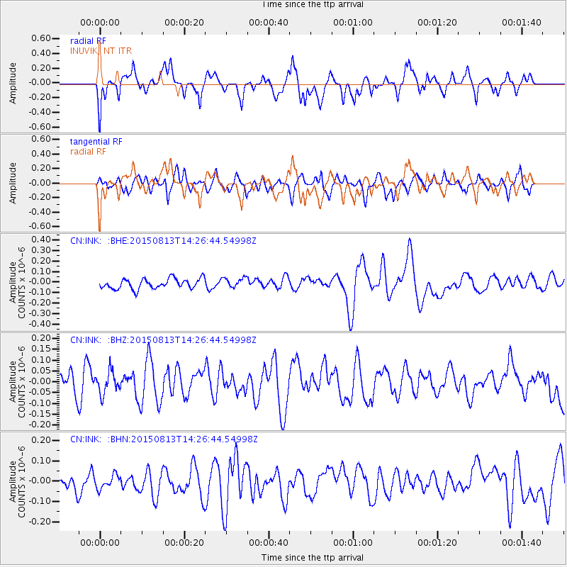
INK INUVIK, NT - Earthquake Result Viewer
*The percent match for this event was below the threshold and hence no stack was calculated.
| Earthquake location: |
Southeast Of Honshu, Japan |
| Earthquake latitude/longitude: |
31.4/142.2 |
| Earthquake time(UTC): |
2015/08/13 (225) 14:17:13 GMT |
| Earthquake Depth: |
3.1 km |
| Earthquake Magnitude: |
4.9 mb |
| Earthquake Catalog/Contributor: |
ISC/ISC |
|
| Network: |
CN Canadian National Seismograph Network |
| Station: |
INK INUVIK, NT |
| Lat/Lon: |
68.31 N/133.53 W |
| Elevation: |
44 m |
|
| Distance: |
59.2 deg |
| Az: |
25.518 deg |
| Baz: |
277.592 deg |
| Ray Param: |
$rayparam |
*The percent match for this event was below the threshold and hence was not used in the summary stack. |
|
| Radial Match: |
50.201683 % |
| Radial Bump: |
400 |
| Transverse Match: |
50.194412 % |
| Transverse Bump: |
400 |
| SOD ConfigId: |
7422571 |
| Insert Time: |
2019-04-20 09:19:12.638 +0000 |
| GWidth: |
2.5 |
| Max Bumps: |
400 |
| Tol: |
0.001 |
|
Signal To Noise
| Channel | StoN | STA | LTA |
| CN:INK: :BHZ:20150813T14:26:44.54998Z | 0.7207208 | 5.2225403E-8 | 7.246274E-8 |
| CN:INK: :BHN:20150813T14:26:44.54998Z | 0.9303325 | 3.3806966E-8 | 3.6338584E-8 |
| CN:INK: :BHE:20150813T14:26:44.54998Z | 0.9852302 | 4.7326086E-8 | 4.8035563E-8 |
| Arrivals |
| Ps | |
| PpPs | |
| PsPs/PpSs | |


