You are here: Home > Network List > TA - USArray Transportable Network (new EarthScope stations) Stations List
> Station O03E Paynes Creek, CA, USA > Earthquake Result Viewer
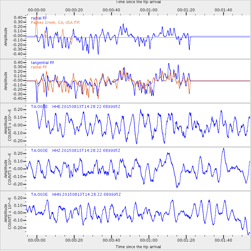
O03E Paynes Creek, CA, USA - Earthquake Result Viewer
*The percent match for this event was below the threshold and hence no stack was calculated.
| Earthquake location: |
Southeast Of Honshu, Japan |
| Earthquake latitude/longitude: |
31.4/142.2 |
| Earthquake time(UTC): |
2015/08/13 (225) 14:17:13 GMT |
| Earthquake Depth: |
3.1 km |
| Earthquake Magnitude: |
4.9 mb |
| Earthquake Catalog/Contributor: |
ISC/ISC |
|
| Network: |
TA USArray Transportable Network (new EarthScope stations) |
| Station: |
O03E Paynes Creek, CA, USA |
| Lat/Lon: |
40.29 N/121.80 W |
| Elevation: |
967 m |
|
| Distance: |
74.6 deg |
| Az: |
52.083 deg |
| Baz: |
298.075 deg |
| Ray Param: |
$rayparam |
*The percent match for this event was below the threshold and hence was not used in the summary stack. |
|
| Radial Match: |
48.07712 % |
| Radial Bump: |
400 |
| Transverse Match: |
51.74473 % |
| Transverse Bump: |
400 |
| SOD ConfigId: |
7422571 |
| Insert Time: |
2019-04-20 09:22:31.363 +0000 |
| GWidth: |
2.5 |
| Max Bumps: |
400 |
| Tol: |
0.001 |
|
Signal To Noise
| Channel | StoN | STA | LTA |
| TA:O03E: :HHZ:20150813T14:28:22.689995Z | 0.82911587 | 8.076539E-8 | 9.7411466E-8 |
| TA:O03E: :HHN:20150813T14:28:22.689995Z | 0.84930545 | 1.5190889E-7 | 1.7886249E-7 |
| TA:O03E: :HHE:20150813T14:28:22.689995Z | 0.73647094 | 6.755013E-8 | 9.172138E-8 |
| Arrivals |
| Ps | |
| PpPs | |
| PsPs/PpSs | |


