You are here: Home > Network List > CI - Caltech Regional Seismic Network Stations List
> Station GLA Glamis, California, USA > Earthquake Result Viewer
GLA Glamis, California, USA - Earthquake Result Viewer
*The percent match for this event was below the threshold and hence no stack was calculated.
| Earthquake location: |
South Of Kermadec Islands |
| Earthquake latitude/longitude: |
-33.3/-178.4 |
| Earthquake time(UTC): |
1998/04/02 (092) 01:09:10 GMT |
| Earthquake Depth: |
33 km |
| Earthquake Magnitude: |
5.7 MS, 5.1 MB |
| Earthquake Catalog/Contributor: |
WHDF/NEIC |
|
| Network: |
CI Caltech Regional Seismic Network |
| Station: |
GLA Glamis, California, USA |
| Lat/Lon: |
33.05 N/114.83 W |
| Elevation: |
627 m |
|
| Distance: |
89.1 deg |
| Az: |
48.803 deg |
| Baz: |
228.622 deg |
| Ray Param: |
$rayparam |
*The percent match for this event was below the threshold and hence was not used in the summary stack. |
|
| Radial Match: |
58.779667 % |
| Radial Bump: |
400 |
| Transverse Match: |
53.85954 % |
| Transverse Bump: |
400 |
| SOD ConfigId: |
4480 |
| Insert Time: |
2010-02-25 23:36:15.149 +0000 |
| GWidth: |
2.5 |
| Max Bumps: |
400 |
| Tol: |
0.001 |
|
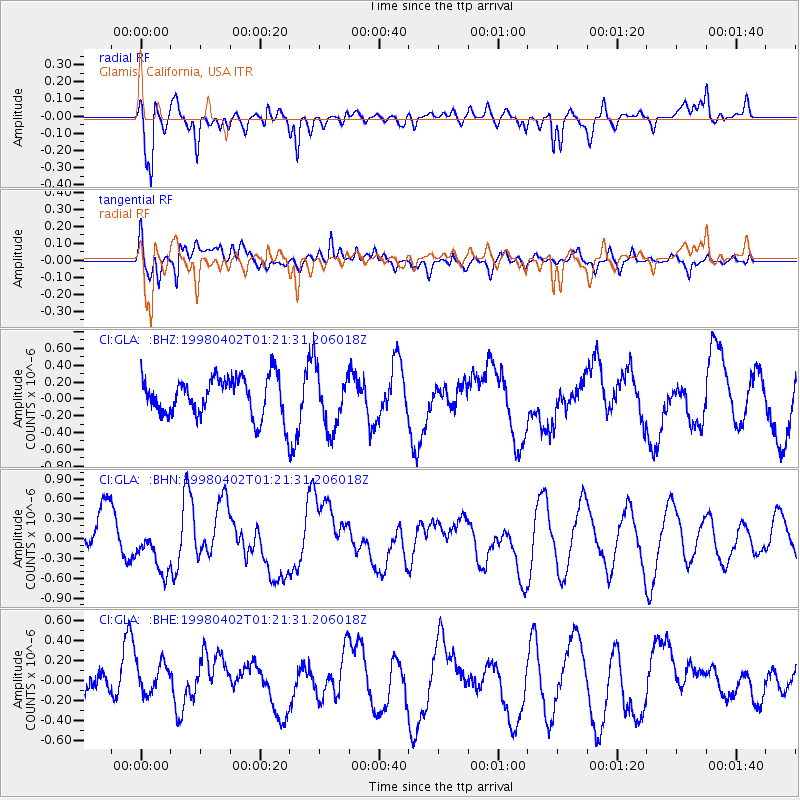
Signal To Noise
| Channel | StoN | STA | LTA |
| CI:GLA: :BHN:19980402T01:21:31.206018Z | 1.4033649 | 3.7677998E-7 | 2.6848326E-7 |
| CI:GLA: :BHE:19980402T01:21:31.206018Z | 1.1372128 | 2.2507838E-7 | 1.9792107E-7 |
| CI:GLA: :BHZ:19980402T01:21:31.206018Z | 1.5288604 | 3.5384335E-7 | 2.3144256E-7 |
| Arrivals |
| Ps | |
| PpPs | |
| PsPs/PpSs | |


