You are here: Home > Network List > US - United States National Seismic Network Stations List
> Station HAWA Hanford, Washington, USA > Earthquake Result Viewer
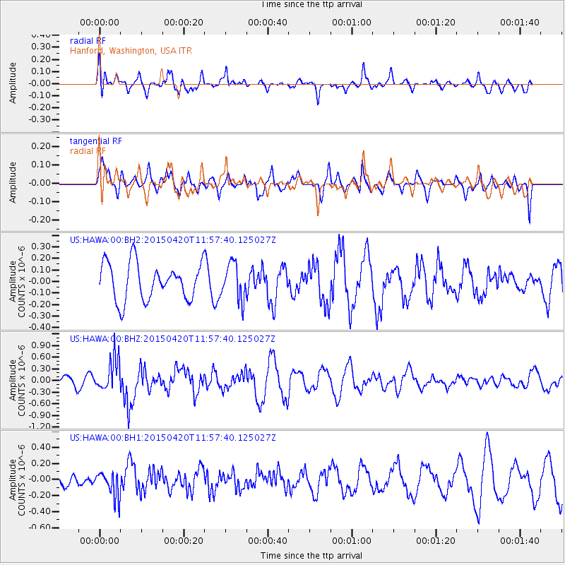
HAWA Hanford, Washington, USA - Earthquake Result Viewer
*The percent match for this event was below the threshold and hence no stack was calculated.
| Earthquake location: |
Taiwan Region |
| Earthquake latitude/longitude: |
24.1/122.5 |
| Earthquake time(UTC): |
2015/04/20 (110) 11:45:14 GMT |
| Earthquake Depth: |
36 km |
| Earthquake Magnitude: |
6.2 MWP |
| Earthquake Catalog/Contributor: |
NEIC PDE/NEIC COMCAT |
|
| Network: |
US United States National Seismic Network |
| Station: |
HAWA Hanford, Washington, USA |
| Lat/Lon: |
46.39 N/119.53 W |
| Elevation: |
364 m |
|
| Distance: |
90.3 deg |
| Az: |
37.668 deg |
| Baz: |
306.193 deg |
| Ray Param: |
$rayparam |
*The percent match for this event was below the threshold and hence was not used in the summary stack. |
|
| Radial Match: |
46.025723 % |
| Radial Bump: |
400 |
| Transverse Match: |
69.65365 % |
| Transverse Bump: |
400 |
| SOD ConfigId: |
872571 |
| Insert Time: |
2015-05-04 12:03:01.898 +0000 |
| GWidth: |
2.5 |
| Max Bumps: |
400 |
| Tol: |
0.001 |
|
Signal To Noise
| Channel | StoN | STA | LTA |
| US:HAWA:00:BHZ:20150420T11:57:40.125027Z | 2.4757705 | 4.3375215E-7 | 1.7519885E-7 |
| US:HAWA:00:BH1:20150420T11:57:40.125027Z | 1.5655929 | 1.5905668E-7 | 1.0159518E-7 |
| US:HAWA:00:BH2:20150420T11:57:40.125027Z | 0.9850562 | 1.5732215E-7 | 1.597088E-7 |
| Arrivals |
| Ps | |
| PpPs | |
| PsPs/PpSs | |


