You are here: Home > Network List > CI - Caltech Regional Seismic Network Stations List
> Station GLA Glamis, California, USA > Earthquake Result Viewer
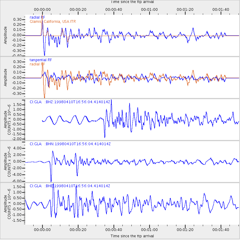
GLA Glamis, California, USA - Earthquake Result Viewer
*The percent match for this event was below the threshold and hence no stack was calculated.
| Earthquake location: |
South Of Kermadec Islands |
| Earthquake latitude/longitude: |
-33.5/-179.5 |
| Earthquake time(UTC): |
1998/04/10 (100) 16:43:41 GMT |
| Earthquake Depth: |
46 km |
| Earthquake Magnitude: |
5.9 MB, 5.9 MS, 6.0 UNKNOWN, 6.0 MW |
| Earthquake Catalog/Contributor: |
WHDF/NEIC |
|
| Network: |
CI Caltech Regional Seismic Network |
| Station: |
GLA Glamis, California, USA |
| Lat/Lon: |
33.05 N/114.83 W |
| Elevation: |
627 m |
|
| Distance: |
89.9 deg |
| Az: |
49.41 deg |
| Baz: |
229.038 deg |
| Ray Param: |
$rayparam |
*The percent match for this event was below the threshold and hence was not used in the summary stack. |
|
| Radial Match: |
77.93878 % |
| Radial Bump: |
400 |
| Transverse Match: |
66.47287 % |
| Transverse Bump: |
400 |
| SOD ConfigId: |
4480 |
| Insert Time: |
2010-02-25 23:36:16.181 +0000 |
| GWidth: |
2.5 |
| Max Bumps: |
400 |
| Tol: |
0.001 |
|
Signal To Noise
| Channel | StoN | STA | LTA |
| CI:GLA: :BHN:19980410T16:56:04.414014Z | 4.345241 | 1.3029409E-6 | 2.9985466E-7 |
| CI:GLA: :BHE:19980410T16:56:04.414014Z | 1.4370153 | 2.8424233E-7 | 1.9780049E-7 |
| CI:GLA: :BHZ:19980410T16:56:04.414014Z | 1.000429 | 2.6927552E-7 | 2.6916004E-7 |
| Arrivals |
| Ps | |
| PpPs | |
| PsPs/PpSs | |


