You are here: Home > Network List > CI - Caltech Regional Seismic Network Stations List
> Station GLA Glamis, California, USA > Earthquake Result Viewer
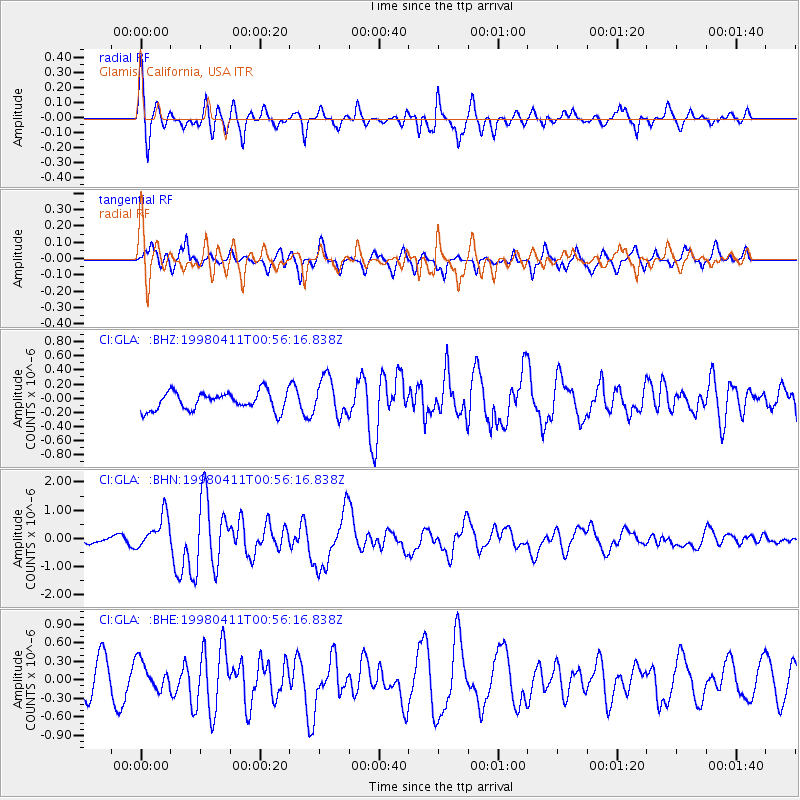
GLA Glamis, California, USA - Earthquake Result Viewer
*The percent match for this event was below the threshold and hence no stack was calculated.
| Earthquake location: |
South Of Fiji Islands |
| Earthquake latitude/longitude: |
-23.6/-176.1 |
| Earthquake time(UTC): |
1998/04/11 (101) 00:44:35 GMT |
| Earthquake Depth: |
33 km |
| Earthquake Magnitude: |
5.7 MB, 6.1 MS, 6.2 UNKNOWN, 6.1 MW |
| Earthquake Catalog/Contributor: |
WHDF/NEIC |
|
| Network: |
CI Caltech Regional Seismic Network |
| Station: |
GLA Glamis, California, USA |
| Lat/Lon: |
33.05 N/114.83 W |
| Elevation: |
627 m |
|
| Distance: |
81.2 deg |
| Az: |
48.194 deg |
| Baz: |
234.486 deg |
| Ray Param: |
$rayparam |
*The percent match for this event was below the threshold and hence was not used in the summary stack. |
|
| Radial Match: |
69.79594 % |
| Radial Bump: |
400 |
| Transverse Match: |
68.88668 % |
| Transverse Bump: |
400 |
| SOD ConfigId: |
4480 |
| Insert Time: |
2010-02-25 23:36:16.922 +0000 |
| GWidth: |
2.5 |
| Max Bumps: |
400 |
| Tol: |
0.001 |
|
Signal To Noise
| Channel | StoN | STA | LTA |
| CI:GLA: :BHN:19980411T00:56:16.838Z | 2.6493864 | 5.987952E-7 | 2.2601279E-7 |
| CI:GLA: :BHE:19980411T00:56:16.838Z | 1.0626332 | 2.312097E-7 | 2.1758187E-7 |
| CI:GLA: :BHZ:19980411T00:56:16.838Z | 2.067052 | 2.6715148E-7 | 1.2924275E-7 |
| Arrivals |
| Ps | |
| PpPs | |
| PsPs/PpSs | |


