You are here: Home > Network List > GS - US Geological Survey Networks Stations List
> Station KAN10 Keim Farm > Earthquake Result Viewer
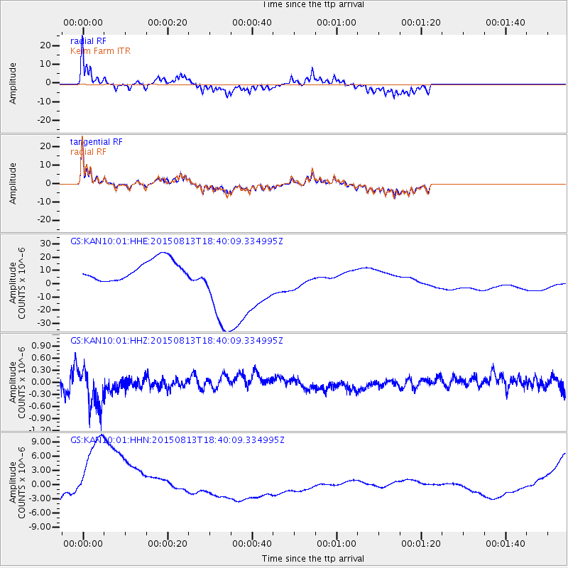
KAN10 Keim Farm - Earthquake Result Viewer
*The percent match for this event was below the threshold and hence no stack was calculated.
| Earthquake location: |
South Of Fiji Islands |
| Earthquake latitude/longitude: |
-24.5/-176.5 |
| Earthquake time(UTC): |
2015/08/13 (225) 18:27:21 GMT |
| Earthquake Depth: |
61 km |
| Earthquake Magnitude: |
4.9 MW |
| Earthquake Catalog/Contributor: |
ISC/ISC |
|
| Network: |
GS US Geological Survey Networks |
| Station: |
KAN10 Keim Farm |
| Lat/Lon: |
37.12 N/98.10 W |
| Elevation: |
417 m |
|
| Distance: |
95.8 deg |
| Az: |
51.917 deg |
| Baz: |
243.829 deg |
| Ray Param: |
$rayparam |
*The percent match for this event was below the threshold and hence was not used in the summary stack. |
|
| Radial Match: |
68.72555 % |
| Radial Bump: |
257 |
| Transverse Match: |
66.72723 % |
| Transverse Bump: |
255 |
| SOD ConfigId: |
7422571 |
| Insert Time: |
2019-04-20 09:31:38.289 +0000 |
| GWidth: |
2.5 |
| Max Bumps: |
400 |
| Tol: |
0.001 |
|
Signal To Noise
| Channel | StoN | STA | LTA |
| GS:KAN10:01:HHZ:20150813T18:40:09.334995Z | 3.7547898 | 5.335104E-7 | 1.4208796E-7 |
| GS:KAN10:01:HHN:20150813T18:40:09.334995Z | 5.3515205 | 1.0403296E-5 | 1.943989E-6 |
| GS:KAN10:01:HHE:20150813T18:40:09.334995Z | 4.7742414 | 3.50788E-5 | 7.3475126E-6 |
| Arrivals |
| Ps | |
| PpPs | |
| PsPs/PpSs | |


