TSUM Tsumeb, Namibia - Earthquake Result Viewer
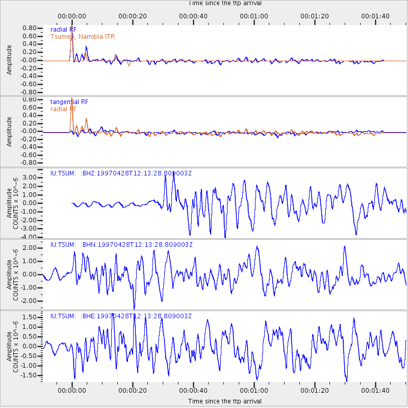
Earthquake location: Prince Edward Islands Region
Earthquake latitude/longitude: -42.5/42.7
Earthquake time(UTC): 1997/04/28 (118) 12:07:37 GMT
Earthquake Depth: 10 km
Earthquake Magnitude: 5.7 MB, 6.3 MS, 6.8 UNKNOWN, 6.5 MW
Earthquake Catalog/Contributor: WHDF/NEIC
Network: IU Global Seismograph Network (GSN - IRIS/USGS)
Station: TSUM Tsumeb, Namibia
Lat/Lon: 19.20 S/17.58 E
Elevation: 1240 m
Distance: 31.5 deg
Az: 309.825 deg
Baz: 143.062 deg
Ray Param: 0.07906138
Estimated Moho Depth: 12.5 km
Estimated Crust Vp/Vs: 1.69
Assumed Crust Vp: 6.51 km/s
Estimated Crust Vs: 3.847 km/s
Estimated Crust Poisson's Ratio: 0.23
Radial Match: 89.52456 %
Radial Bump: 247
Transverse Match: 61.439445 %
Transverse Bump: 400
SOD ConfigId: 6273
Insert Time: 2010-03-04 15:33:25.318 +0000
GWidth: 2.5
Max Bumps: 400
Tol: 0.001

Signal To Noise

ChannelStoNSTALTA
IU:TSUM: :BHN:19970428T12:13:28.809003Z3.50977139.466239E-72.69711E-7
IU:TSUM: :BHE:19970428T12:13:28.809003Z2.38819815.620388E-72.3534008E-7
IU:TSUM: :BHZ:19970428T12:13:28.809003Z9.3422161.663417E-61.7805381E-7
Arrivals
Ps1.4 SECOND
PpPs4.7 SECOND
PsPs/PpSs6.2 SECOND