TSUM Tsumeb, Namibia - Earthquake Result Viewer
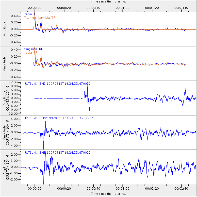
Earthquake location: Hindu Kush Region, Afghanistan
Earthquake latitude/longitude: 36.4/70.9
Earthquake time(UTC): 1997/05/13 (133) 14:13:45 GMT
Earthquake Depth: 196 km
Earthquake Magnitude: 6.1 MB, 6.5 UNKNOWN, 6.4 MW
Earthquake Catalog/Contributor: WHDF/NEIC
Network: IU Global Seismograph Network (GSN - IRIS/USGS)
Station: TSUM Tsumeb, Namibia
Lat/Lon: 19.20 S/17.58 E
Elevation: 1240 m
Distance: 74.8 deg
Az: 231.786 deg
Baz: 42.119 deg
Ray Param: 0.051561557
Estimated Moho Depth: 10.0 km
Estimated Crust Vp/Vs: 1.95
Assumed Crust Vp: 6.51 km/s
Estimated Crust Vs: 3.339 km/s
Estimated Crust Poisson's Ratio: 0.32
Radial Match: 87.39703 %
Radial Bump: 400
Transverse Match: 74.656265 %
Transverse Bump: 400
SOD ConfigId: 6273
Insert Time: 2010-03-04 15:33:30.550 +0000
GWidth: 2.5
Max Bumps: 400
Tol: 0.001

Signal To Noise

ChannelStoNSTALTA
IU:TSUM: :BHN:19970513T14:24:33.470996Z2.59024885.242704E-72.0240154E-7
IU:TSUM: :BHE:19970513T14:24:33.47002Z2.02046183.9976425E-71.9785784E-7
IU:TSUM: :BHZ:19970513T14:24:33.47002Z10.5724811.5173299E-61.4351691E-7
Arrivals
Ps1.5 SECOND
PpPs4.4 SECOND
PsPs/PpSs5.9 SECOND