TSUM Tsumeb, Namibia - Earthquake Result Viewer
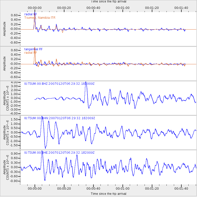
Earthquake location: South Sandwich Islands Region
Earthquake latitude/longitude: -55.4/-29.5
Earthquake time(UTC): 2007/01/20 (020) 06:21:04 GMT
Earthquake Depth: 10 km
Earthquake Magnitude: 5.7 MB, 6.2 MS, 6.2 MW, 6.1 MW
Earthquake Catalog/Contributor: WHDF/NEIC
Network: IU Global Seismograph Network (GSN - IRIS/USGS)
Station: TSUM Tsumeb, Namibia
Lat/Lon: 19.20 S/17.58 E
Elevation: 1240 m
Distance: 50.6 deg
Az: 63.721 deg
Baz: 212.749 deg
Ray Param: 0.067974806
Estimated Moho Depth: 38.5 km
Estimated Crust Vp/Vs: 1.67
Assumed Crust Vp: 6.51 km/s
Estimated Crust Vs: 3.904 km/s
Estimated Crust Poisson's Ratio: 0.22
Radial Match: 92.924225 %
Radial Bump: 303
Transverse Match: 67.000824 %
Transverse Bump: 400
SOD ConfigId: 2564
Insert Time: 2010-03-04 15:34:14.914 +0000
GWidth: 2.5
Max Bumps: 400
Tol: 0.001

Signal To Noise

ChannelStoNSTALTA
IU:TSUM:00:BHN:20070120T06:29:32.182009Z4.485715.90807E-71.3170869E-7
IU:TSUM:00:BHE:20070120T06:29:32.182009Z2.00172972.8035012E-71.4005393E-7
IU:TSUM:00:BHZ:20070120T06:29:32.182009Z6.6549751.2516601E-61.8807886E-7
Arrivals
Ps4.2 SECOND
PpPs15 SECOND
PsPs/PpSs19 SECOND