TSUM Tsumeb, Namibia - Earthquake Result Viewer
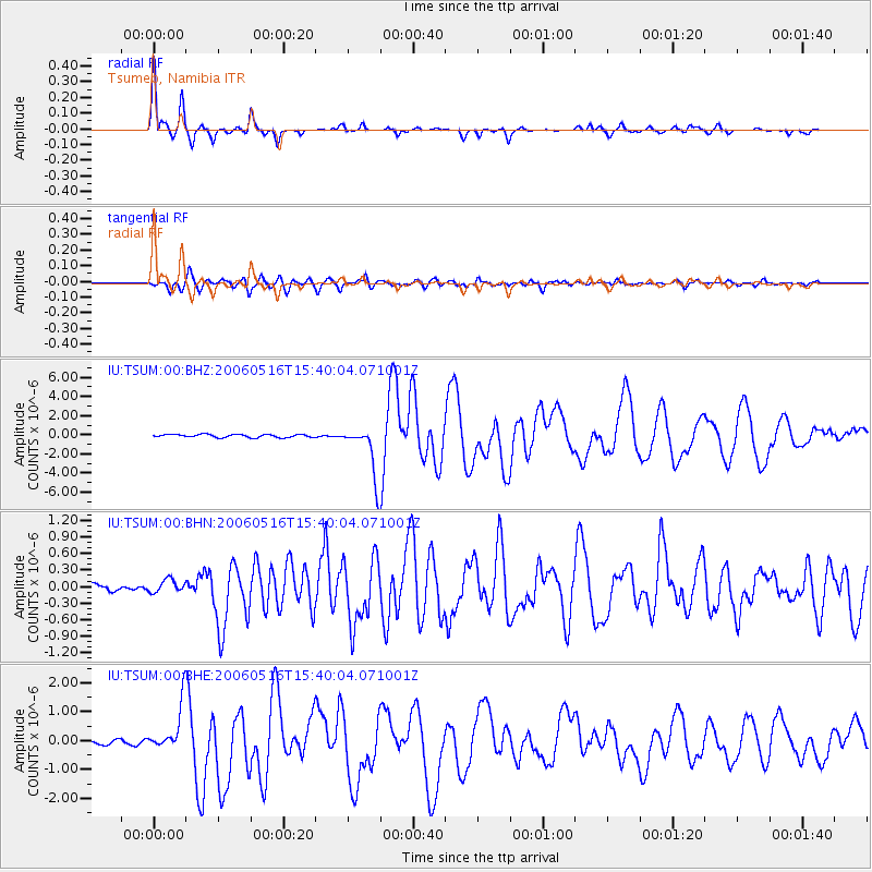
Earthquake location: Northern Sumatra, Indonesia
Earthquake latitude/longitude: 0.1/97.1
Earthquake time(UTC): 2006/05/16 (136) 15:28:25 GMT
Earthquake Depth: 12 km
Earthquake Magnitude: 6.6 MB, 6.8 MS, 6.8 MW, 6.8 MW
Earthquake Catalog/Contributor: WHDF/NEIC
Network: IU Global Seismograph Network (GSN - IRIS/USGS)
Station: TSUM Tsumeb, Namibia
Lat/Lon: 19.20 S/17.58 E
Elevation: 1240 m
Distance: 80.1 deg
Az: 250.599 deg
Baz: 86.433 deg
Ray Param: 0.048516344
Estimated Moho Depth: 36.75 km
Estimated Crust Vp/Vs: 1.74
Assumed Crust Vp: 6.51 km/s
Estimated Crust Vs: 3.747 km/s
Estimated Crust Poisson's Ratio: 0.25
Radial Match: 96.53915 %
Radial Bump: 263
Transverse Match: 91.63218 %
Transverse Bump: 400
SOD ConfigId: 2669
Insert Time: 2010-03-04 15:34:48.881 +0000
GWidth: 2.5
Max Bumps: 400
Tol: 0.001

Signal To Noise

ChannelStoNSTALTA
IU:TSUM:00:BHN:20060516T15:40:04.071001Z1.1965931.2943973E-71.08173566E-7
IU:TSUM:00:BHE:20060516T15:40:04.071001Z6.7060418.439317E-71.2584648E-7
IU:TSUM:00:BHZ:20060516T15:40:04.071001Z17.0184672.7454394E-61.613212E-7
Arrivals
Ps4.3 SECOND
PpPs15 SECOND
PsPs/PpSs19 SECOND