You are here: Home > Network List > TA - USArray Transportable Network (new EarthScope stations) Stations List
> Station I59A Olmsteadville, NY, USA > Earthquake Result Viewer
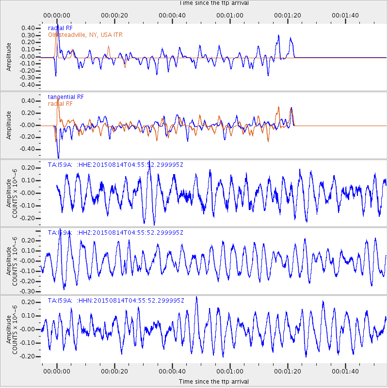
I59A Olmsteadville, NY, USA - Earthquake Result Viewer
*The percent match for this event was below the threshold and hence no stack was calculated.
| Earthquake location: |
Hokkaido, Japan Region |
| Earthquake latitude/longitude: |
42.8/143.1 |
| Earthquake time(UTC): |
2015/08/14 (226) 04:43:44 GMT |
| Earthquake Depth: |
85 km |
| Earthquake Magnitude: |
5.2 MW |
| Earthquake Catalog/Contributor: |
ISC/ISC |
|
| Network: |
TA USArray Transportable Network (new EarthScope stations) |
| Station: |
I59A Olmsteadville, NY, USA |
| Lat/Lon: |
43.80 N/73.87 W |
| Elevation: |
390 m |
|
| Distance: |
87.7 deg |
| Az: |
25.872 deg |
| Baz: |
333.659 deg |
| Ray Param: |
$rayparam |
*The percent match for this event was below the threshold and hence was not used in the summary stack. |
|
| Radial Match: |
61.582134 % |
| Radial Bump: |
400 |
| Transverse Match: |
71.71132 % |
| Transverse Bump: |
400 |
| SOD ConfigId: |
7422571 |
| Insert Time: |
2019-04-20 09:42:13.633 +0000 |
| GWidth: |
2.5 |
| Max Bumps: |
400 |
| Tol: |
0.001 |
|
Signal To Noise
| Channel | StoN | STA | LTA |
| TA:I59A: :HHZ:20150814T04:55:52.299995Z | 1.8416826 | 1.890176E-7 | 1.026331E-7 |
| TA:I59A: :HHN:20150814T04:55:52.299995Z | 0.72853035 | 6.892449E-8 | 9.460758E-8 |
| TA:I59A: :HHE:20150814T04:55:52.299995Z | 1.9012843 | 1.5362646E-7 | 8.0801414E-8 |
| Arrivals |
| Ps | |
| PpPs | |
| PsPs/PpSs | |


