You are here: Home > Network List > US - United States National Seismic Network Stations List
> Station DGMT Dagmar, Montana, USA > Earthquake Result Viewer
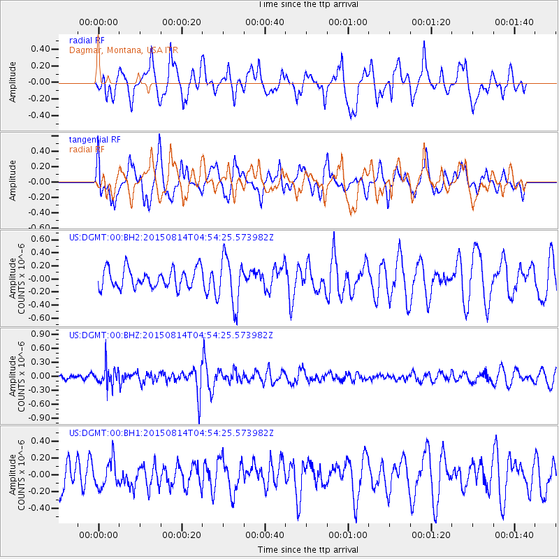
DGMT Dagmar, Montana, USA - Earthquake Result Viewer
*The percent match for this event was below the threshold and hence no stack was calculated.
| Earthquake location: |
Hokkaido, Japan Region |
| Earthquake latitude/longitude: |
42.8/143.1 |
| Earthquake time(UTC): |
2015/08/14 (226) 04:43:44 GMT |
| Earthquake Depth: |
85 km |
| Earthquake Magnitude: |
5.2 MW |
| Earthquake Catalog/Contributor: |
ISC/ISC |
|
| Network: |
US United States National Seismic Network |
| Station: |
DGMT Dagmar, Montana, USA |
| Lat/Lon: |
48.47 N/104.20 W |
| Elevation: |
0.0 m |
|
| Distance: |
71.6 deg |
| Az: |
40.343 deg |
| Baz: |
314.254 deg |
| Ray Param: |
$rayparam |
*The percent match for this event was below the threshold and hence was not used in the summary stack. |
|
| Radial Match: |
61.237846 % |
| Radial Bump: |
400 |
| Transverse Match: |
51.81741 % |
| Transverse Bump: |
400 |
| SOD ConfigId: |
7422571 |
| Insert Time: |
2019-04-20 09:43:15.525 +0000 |
| GWidth: |
2.5 |
| Max Bumps: |
400 |
| Tol: |
0.001 |
|
Signal To Noise
| Channel | StoN | STA | LTA |
| US:DGMT:00:BHZ:20150814T04:54:25.573982Z | 1.9567181 | 2.1129325E-7 | 1.07983496E-7 |
| US:DGMT:00:BH1:20150814T04:54:25.573982Z | 0.6375032 | 1.631182E-7 | 2.5587042E-7 |
| US:DGMT:00:BH2:20150814T04:54:25.573982Z | 2.5253408 | 3.673681E-7 | 1.454727E-7 |
| Arrivals |
| Ps | |
| PpPs | |
| PsPs/PpSs | |


