You are here: Home > Network List > TA - USArray Transportable Network (new EarthScope stations) Stations List
> Station A04D Lummi Island, WA, USA > Earthquake Result Viewer
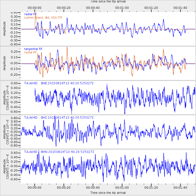
A04D Lummi Island, WA, USA - Earthquake Result Viewer
*The percent match for this event was below the threshold and hence no stack was calculated.
| Earthquake location: |
Kermadec Islands Region |
| Earthquake latitude/longitude: |
-27.3/-176.0 |
| Earthquake time(UTC): |
2015/08/14 (226) 13:28:00 GMT |
| Earthquake Depth: |
13 km |
| Earthquake Magnitude: |
5.6 MB |
| Earthquake Catalog/Contributor: |
NEIC PDE/NEIC COMCAT |
|
| Network: |
TA USArray Transportable Network (new EarthScope stations) |
| Station: |
A04D Lummi Island, WA, USA |
| Lat/Lon: |
48.72 N/122.71 W |
| Elevation: |
13 m |
|
| Distance: |
89.4 deg |
| Az: |
32.088 deg |
| Baz: |
225.536 deg |
| Ray Param: |
$rayparam |
*The percent match for this event was below the threshold and hence was not used in the summary stack. |
|
| Radial Match: |
48.65325 % |
| Radial Bump: |
400 |
| Transverse Match: |
50.719753 % |
| Transverse Bump: |
400 |
| SOD ConfigId: |
7422571 |
| Insert Time: |
2019-04-20 09:53:02.059 +0000 |
| GWidth: |
2.5 |
| Max Bumps: |
400 |
| Tol: |
0.001 |
|
Signal To Noise
| Channel | StoN | STA | LTA |
| TA:A04D: :BHZ:20150814T13:40:26.525027Z | 1.3058869 | 1.5628198E-7 | 1.1967498E-7 |
| TA:A04D: :BHN:20150814T13:40:26.525027Z | 1.4144282 | 2.64881E-7 | 1.8727074E-7 |
| TA:A04D: :BHE:20150814T13:40:26.525027Z | 1.1457508 | 1.8920522E-7 | 1.6513646E-7 |
| Arrivals |
| Ps | |
| PpPs | |
| PsPs/PpSs | |


