You are here: Home > Network List > UW - Pacific Northwest Regional Seismic Network Stations List
> Station MRBL Marblemount, WA, USA > Earthquake Result Viewer
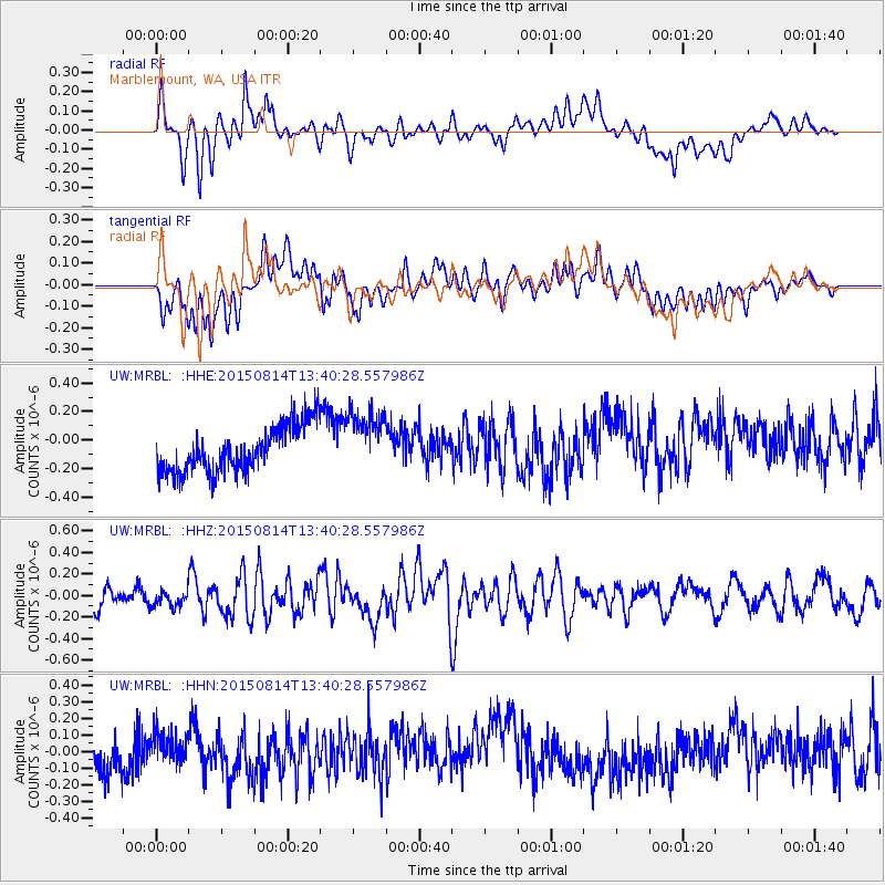
MRBL Marblemount, WA, USA - Earthquake Result Viewer
*The percent match for this event was below the threshold and hence no stack was calculated.
| Earthquake location: |
Kermadec Islands Region |
| Earthquake latitude/longitude: |
-27.3/-176.0 |
| Earthquake time(UTC): |
2015/08/14 (226) 13:28:00 GMT |
| Earthquake Depth: |
13 km |
| Earthquake Magnitude: |
5.6 MB |
| Earthquake Catalog/Contributor: |
NEIC PDE/NEIC COMCAT |
|
| Network: |
UW Pacific Northwest Regional Seismic Network |
| Station: |
MRBL Marblemount, WA, USA |
| Lat/Lon: |
48.52 N/121.48 W |
| Elevation: |
75 m |
|
| Distance: |
89.9 deg |
| Az: |
32.796 deg |
| Baz: |
226.455 deg |
| Ray Param: |
$rayparam |
*The percent match for this event was below the threshold and hence was not used in the summary stack. |
|
| Radial Match: |
47.45498 % |
| Radial Bump: |
400 |
| Transverse Match: |
46.44457 % |
| Transverse Bump: |
400 |
| SOD ConfigId: |
7422571 |
| Insert Time: |
2019-04-20 09:54:15.289 +0000 |
| GWidth: |
2.5 |
| Max Bumps: |
400 |
| Tol: |
0.001 |
|
Signal To Noise
| Channel | StoN | STA | LTA |
| UW:MRBL: :HHZ:20150814T13:40:28.557986Z | 0.8825368 | 7.512525E-8 | 8.512421E-8 |
| UW:MRBL: :HHN:20150814T13:40:28.557986Z | 0.84975123 | 8.714071E-8 | 1.0254849E-7 |
| UW:MRBL: :HHE:20150814T13:40:28.557986Z | 1.4480865 | 2.2358016E-7 | 1.5439697E-7 |
| Arrivals |
| Ps | |
| PpPs | |
| PsPs/PpSs | |


