You are here: Home > Network List > AV - Alaska Volcano Observatory Stations List
> Station MAPS Pakushin Southeast, Makushin Volcano, Alaska > Earthquake Result Viewer
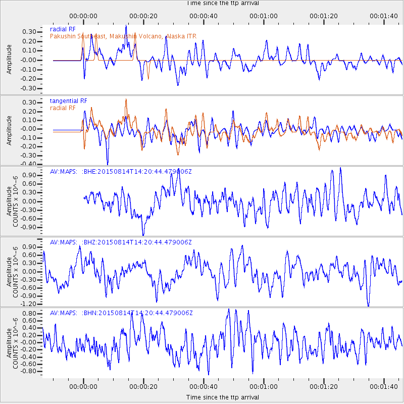
MAPS Pakushin Southeast, Makushin Volcano, Alaska - Earthquake Result Viewer
*The percent match for this event was below the threshold and hence no stack was calculated.
| Earthquake location: |
South Of Fiji Islands |
| Earthquake latitude/longitude: |
-26.1/-177.1 |
| Earthquake time(UTC): |
2015/08/14 (226) 14:09:16 GMT |
| Earthquake Depth: |
96 km |
| Earthquake Magnitude: |
5.4 MW |
| Earthquake Catalog/Contributor: |
ISC/ISC |
|
| Network: |
AV Alaska Volcano Observatory |
| Station: |
MAPS Pakushin Southeast, Makushin Volcano, Alaska |
| Lat/Lon: |
53.81 N/166.94 W |
| Elevation: |
333 m |
|
| Distance: |
80.1 deg |
| Az: |
6.087 deg |
| Baz: |
189.249 deg |
| Ray Param: |
$rayparam |
*The percent match for this event was below the threshold and hence was not used in the summary stack. |
|
| Radial Match: |
52.024918 % |
| Radial Bump: |
400 |
| Transverse Match: |
52.588024 % |
| Transverse Bump: |
400 |
| SOD ConfigId: |
7422571 |
| Insert Time: |
2019-04-20 10:02:38.241 +0000 |
| GWidth: |
2.5 |
| Max Bumps: |
400 |
| Tol: |
0.001 |
|
Signal To Noise
| Channel | StoN | STA | LTA |
| AV:MAPS: :BHZ:20150814T14:20:44.479006Z | 1.2644047 | 4.4892394E-7 | 3.550477E-7 |
| AV:MAPS: :BHN:20150814T14:20:44.479006Z | 0.55139256 | 1.8608748E-7 | 3.374864E-7 |
| AV:MAPS: :BHE:20150814T14:20:44.479006Z | 2.0219066 | 7.1929634E-7 | 3.5575152E-7 |
| Arrivals |
| Ps | |
| PpPs | |
| PsPs/PpSs | |


