You are here: Home > Network List > CI - Caltech Regional Seismic Network Stations List
> Station GLA Glamis, Glamis, CA, USA > Earthquake Result Viewer
GLA Glamis, Glamis, CA, USA - Earthquake Result Viewer
*The percent match for this event was below the threshold and hence no stack was calculated.
| Earthquake location: |
Loyalty Islands |
| Earthquake latitude/longitude: |
-20.3/168.9 |
| Earthquake time(UTC): |
2008/04/10 (101) 01:10:02 GMT |
| Earthquake Depth: |
35 km |
| Earthquake Magnitude: |
5.5 MB, 5.5 MS, 5.8 MW |
| Earthquake Catalog/Contributor: |
WHDF/NEIC |
|
| Network: |
CI Caltech Regional Seismic Network |
| Station: |
GLA Glamis, Glamis, CA, USA |
| Lat/Lon: |
33.05 N/114.83 W |
| Elevation: |
610 m |
|
| Distance: |
90.0 deg |
| Az: |
54.66 deg |
| Baz: |
245.712 deg |
| Ray Param: |
$rayparam |
*The percent match for this event was below the threshold and hence was not used in the summary stack. |
|
| Radial Match: |
40.13912 % |
| Radial Bump: |
400 |
| Transverse Match: |
34.001736 % |
| Transverse Bump: |
400 |
| SOD ConfigId: |
2504 |
| Insert Time: |
2010-02-25 23:36:32.821 +0000 |
| GWidth: |
2.5 |
| Max Bumps: |
400 |
| Tol: |
0.001 |
|
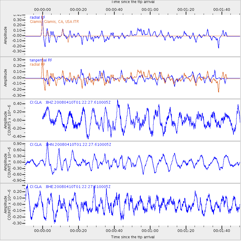
Signal To Noise
| Channel | StoN | STA | LTA |
| CI:GLA: :BHN:20080410T01:22:27.610005Z | 3.0112479 | 3.47496E-7 | 1.15399345E-7 |
| CI:GLA: :BHE:20080410T01:22:27.610005Z | 0.82620436 | 1.5904281E-7 | 1.9249816E-7 |
| CI:GLA: :BHZ:20080410T01:22:27.610005Z | 0.98431915 | 1.5231414E-7 | 1.5474062E-7 |
| Arrivals |
| Ps | |
| PpPs | |
| PsPs/PpSs | |


