You are here: Home > Network List > IU - Global Seismograph Network (GSN - IRIS/USGS) Stations List
> Station TSUM Tsumeb, Namibia > Earthquake Result Viewer
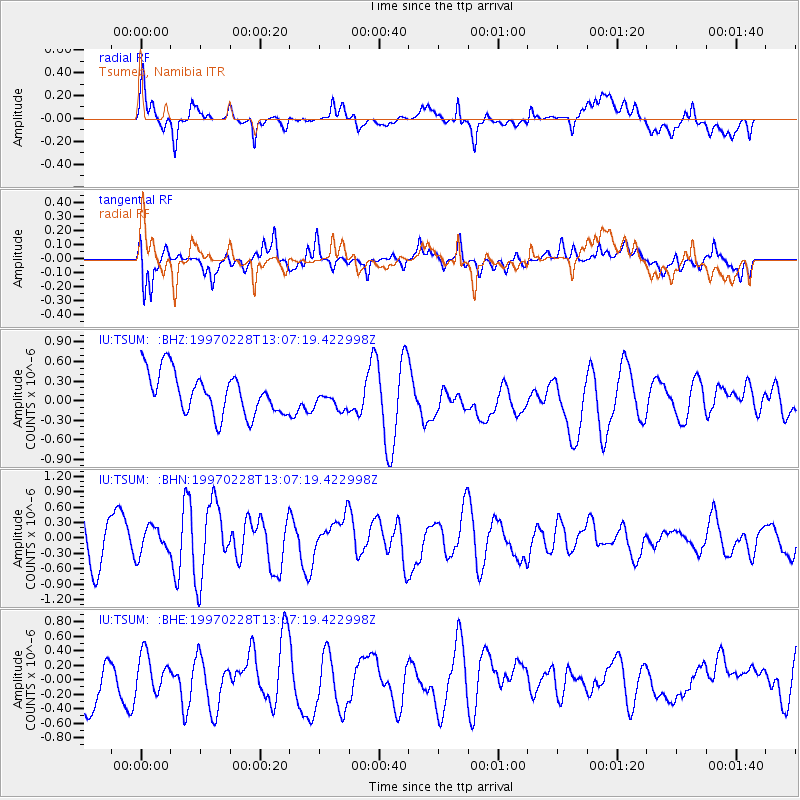
TSUM Tsumeb, Namibia - Earthquake Result Viewer
*The percent match for this event was below the threshold and hence no stack was calculated.
| Earthquake location: |
Armenia-Azerbaijan-Iran Bord Reg |
| Earthquake latitude/longitude: |
38.1/48.0 |
| Earthquake time(UTC): |
1997/02/28 (059) 12:57:18 GMT |
| Earthquake Depth: |
10 km |
| Earthquake Magnitude: |
5.5 MB, 6.1 MS, 6.1 UNKNOWN, 6.0 MW |
| Earthquake Catalog/Contributor: |
WHDF/NEIC |
|
| Network: |
IU Global Seismograph Network (GSN - IRIS/USGS) |
| Station: |
TSUM Tsumeb, Namibia |
| Lat/Lon: |
19.20 S/17.58 E |
| Elevation: |
1240 m |
|
| Distance: |
63.8 deg |
| Az: |
212.29 deg |
| Baz: |
26.495 deg |
| Ray Param: |
$rayparam |
*The percent match for this event was below the threshold and hence was not used in the summary stack. |
|
| Radial Match: |
65.226685 % |
| Radial Bump: |
400 |
| Transverse Match: |
72.62862 % |
| Transverse Bump: |
400 |
| SOD ConfigId: |
4480 |
| Insert Time: |
2010-03-04 15:37:19.453 +0000 |
| GWidth: |
2.5 |
| Max Bumps: |
400 |
| Tol: |
0.001 |
|
Signal To Noise
| Channel | StoN | STA | LTA |
| IU:TSUM: :BHN:19970228T13:07:19.422998Z | 0.6145177 | 2.641777E-7 | 4.2989433E-7 |
| IU:TSUM: :BHE:19970228T13:07:19.422998Z | 0.66096354 | 2.455087E-7 | 3.714406E-7 |
| IU:TSUM: :BHZ:19970228T13:07:19.422998Z | 0.5281543 | 1.6952252E-7 | 3.2097157E-7 |
| Arrivals |
| Ps | |
| PpPs | |
| PsPs/PpSs | |


