You are here: Home > Network List > CI - Caltech Regional Seismic Network Stations List
> Station GLA Glamis, Glamis, CA, USA > Earthquake Result Viewer
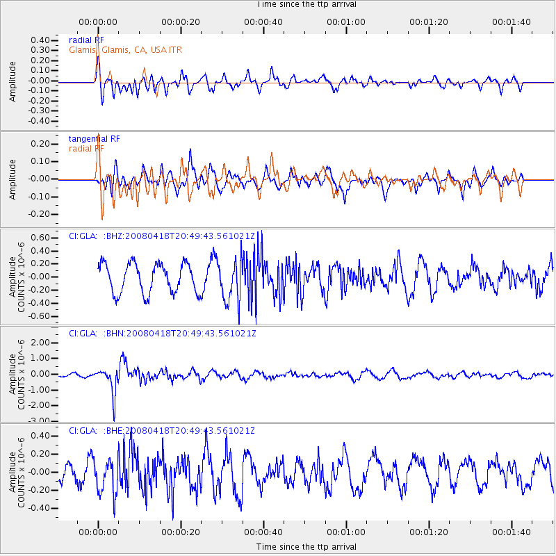
GLA Glamis, Glamis, CA, USA - Earthquake Result Viewer
*The percent match for this event was below the threshold and hence no stack was calculated.
| Earthquake location: |
Fiji Islands Region |
| Earthquake latitude/longitude: |
-17.3/-179.0 |
| Earthquake time(UTC): |
2008/04/18 (109) 20:39:07 GMT |
| Earthquake Depth: |
554 km |
| Earthquake Magnitude: |
5.9 MB, 6.3 MW, 6.3 MW |
| Earthquake Catalog/Contributor: |
WHDF/NEIC |
|
| Network: |
CI Caltech Regional Seismic Network |
| Station: |
GLA Glamis, Glamis, CA, USA |
| Lat/Lon: |
33.05 N/114.83 W |
| Elevation: |
610 m |
|
| Distance: |
79.1 deg |
| Az: |
50.343 deg |
| Baz: |
241.109 deg |
| Ray Param: |
$rayparam |
*The percent match for this event was below the threshold and hence was not used in the summary stack. |
|
| Radial Match: |
49.818443 % |
| Radial Bump: |
400 |
| Transverse Match: |
50.37327 % |
| Transverse Bump: |
400 |
| SOD ConfigId: |
2504 |
| Insert Time: |
2010-02-25 23:36:38.644 +0000 |
| GWidth: |
2.5 |
| Max Bumps: |
400 |
| Tol: |
0.001 |
|
Signal To Noise
| Channel | StoN | STA | LTA |
| CI:GLA: :BHN:20080418T20:49:43.561021Z | 4.802256 | 8.4884744E-7 | 1.7676014E-7 |
| CI:GLA: :BHE:20080418T20:49:43.561021Z | 1.9603218 | 1.9144974E-7 | 9.766241E-8 |
| CI:GLA: :BHZ:20080418T20:49:43.561021Z | 1.4159693 | 3.156419E-7 | 2.2291577E-7 |
| Arrivals |
| Ps | |
| PpPs | |
| PsPs/PpSs | |


