You are here: Home > Network List > AZ - ANZA Regional Network Stations List
> Station LVA2 AZ.LVA2 > Earthquake Result Viewer
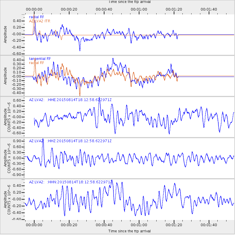
LVA2 AZ.LVA2 - Earthquake Result Viewer
*The percent match for this event was below the threshold and hence no stack was calculated.
| Earthquake location: |
Northern Mid-Atlantic Ridge |
| Earthquake latitude/longitude: |
21.1/-45.9 |
| Earthquake time(UTC): |
2015/08/14 (226) 18:03:03 GMT |
| Earthquake Depth: |
13 km |
| Earthquake Magnitude: |
5.5 MB |
| Earthquake Catalog/Contributor: |
NEIC PDE/NEIC COMCAT |
|
| Network: |
AZ ANZA Regional Network |
| Station: |
LVA2 AZ.LVA2 |
| Lat/Lon: |
33.35 N/116.56 W |
| Elevation: |
1435 m |
|
| Distance: |
63.0 deg |
| Az: |
297.533 deg |
| Baz: |
81.56 deg |
| Ray Param: |
$rayparam |
*The percent match for this event was below the threshold and hence was not used in the summary stack. |
|
| Radial Match: |
46.14331 % |
| Radial Bump: |
400 |
| Transverse Match: |
29.831486 % |
| Transverse Bump: |
400 |
| SOD ConfigId: |
7422571 |
| Insert Time: |
2019-04-20 10:10:21.348 +0000 |
| GWidth: |
2.5 |
| Max Bumps: |
400 |
| Tol: |
0.001 |
|
Signal To Noise
| Channel | StoN | STA | LTA |
| AZ:LVA2: :HHZ:20150814T18:12:58.622971Z | 2.7536232 | 2.6254253E-7 | 9.534438E-8 |
| AZ:LVA2: :HHN:20150814T18:12:58.622971Z | 1.0832152 | 2.7248586E-7 | 2.5155285E-7 |
| AZ:LVA2: :HHE:20150814T18:12:58.622971Z | 2.0582554 | 2.5457481E-7 | 1.2368476E-7 |
| Arrivals |
| Ps | |
| PpPs | |
| PsPs/PpSs | |


