You are here: Home > Network List > AZ - ANZA Regional Network Stations List
> Station SMER AZ.SMER > Earthquake Result Viewer
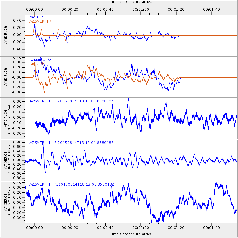
SMER AZ.SMER - Earthquake Result Viewer
*The percent match for this event was below the threshold and hence no stack was calculated.
| Earthquake location: |
Northern Mid-Atlantic Ridge |
| Earthquake latitude/longitude: |
21.1/-45.9 |
| Earthquake time(UTC): |
2015/08/14 (226) 18:03:03 GMT |
| Earthquake Depth: |
13 km |
| Earthquake Magnitude: |
5.5 MB |
| Earthquake Catalog/Contributor: |
NEIC PDE/NEIC COMCAT |
|
| Network: |
AZ ANZA Regional Network |
| Station: |
SMER AZ.SMER |
| Lat/Lon: |
33.46 N/117.17 W |
| Elevation: |
355 m |
|
| Distance: |
63.5 deg |
| Az: |
297.735 deg |
| Baz: |
81.318 deg |
| Ray Param: |
$rayparam |
*The percent match for this event was below the threshold and hence was not used in the summary stack. |
|
| Radial Match: |
34.832287 % |
| Radial Bump: |
400 |
| Transverse Match: |
20.047983 % |
| Transverse Bump: |
400 |
| SOD ConfigId: |
7422571 |
| Insert Time: |
2019-04-20 10:10:24.814 +0000 |
| GWidth: |
2.5 |
| Max Bumps: |
400 |
| Tol: |
0.001 |
|
Signal To Noise
| Channel | StoN | STA | LTA |
| AZ:SMER: :HHZ:20150814T18:13:01.858018Z | 4.8883443 | 3.023063E-7 | 6.184227E-8 |
| AZ:SMER: :HHN:20150814T18:13:01.858018Z | 1.2267852 | 2.287797E-7 | 1.8648718E-7 |
| AZ:SMER: :HHE:20150814T18:13:01.858018Z | 1.59911 | 1.4066009E-7 | 8.796148E-8 |
| Arrivals |
| Ps | |
| PpPs | |
| PsPs/PpSs | |


