
CCM Cathedral Cave, Missouri, USA - Earthquake Result Viewer
| ||||||||||||||||||
| ||||||||||||||||||
| ||||||||||||||||||
|
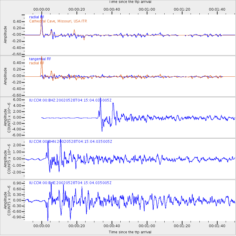
Signal To Noise
| Channel | StoN | STA | LTA |
| IU:CCM:00:BHN:20020528T04:15:04.035005Z | 16.75211 | 8.6962456E-7 | 5.1911346E-8 |
| IU:CCM:00:BHE:20020528T04:15:04.035005Z | 5.156458 | 2.9679344E-7 | 5.755762E-8 |
| IU:CCM:00:BHZ:20020528T04:15:04.035005Z | 32.49173 | 2.0946882E-6 | 6.446835E-8 |
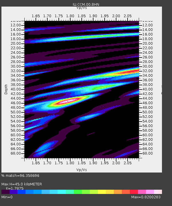
| Arrivals | |
| Ps | 5.7 SECOND |
| PpPs | 19 SECOND |
| PsPs/PpSs | 24 SECOND |

