You are here: Home > Network List > US - United States National Seismic Network Stations List
> Station MNTX Cornudas Mountains, Texas, USA > Earthquake Result Viewer
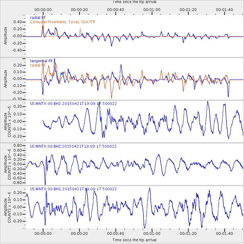
MNTX Cornudas Mountains, Texas, USA - Earthquake Result Viewer
*The percent match for this event was below the threshold and hence no stack was calculated.
| Earthquake location: |
Central Peru |
| Earthquake latitude/longitude: |
-14.6/-71.1 |
| Earthquake time(UTC): |
2015/04/21 (111) 19:00:17 GMT |
| Earthquake Depth: |
119 km |
| Earthquake Magnitude: |
5.6 MB |
| Earthquake Catalog/Contributor: |
NEIC PDE/NEIC COMCAT |
|
| Network: |
US United States National Seismic Network |
| Station: |
MNTX Cornudas Mountains, Texas, USA |
| Lat/Lon: |
31.70 N/105.38 W |
| Elevation: |
404 m |
|
| Distance: |
56.6 deg |
| Az: |
324.885 deg |
| Baz: |
139.207 deg |
| Ray Param: |
$rayparam |
*The percent match for this event was below the threshold and hence was not used in the summary stack. |
|
| Radial Match: |
52.941242 % |
| Radial Bump: |
400 |
| Transverse Match: |
58.35176 % |
| Transverse Bump: |
400 |
| SOD ConfigId: |
872571 |
| Insert Time: |
2015-05-05 19:10:38.398 +0000 |
| GWidth: |
2.5 |
| Max Bumps: |
400 |
| Tol: |
0.001 |
|
Signal To Noise
| Channel | StoN | STA | LTA |
| US:MNTX:00:BHZ:20150421T19:09:17.50002Z | 1.6765742 | 3.0689432E-7 | 1.8304846E-7 |
| US:MNTX:00:BH1:20150421T19:09:17.50002Z | 0.9904733 | 1.2260409E-7 | 1.2378334E-7 |
| US:MNTX:00:BH2:20150421T19:09:17.50002Z | 2.2189684 | 1.488529E-7 | 6.7082034E-8 |
| Arrivals |
| Ps | |
| PpPs | |
| PsPs/PpSs | |


