You are here: Home > Network List > TA - USArray Transportable Network (new EarthScope stations) Stations List
> Station J61A Chester, VT, USA > Earthquake Result Viewer
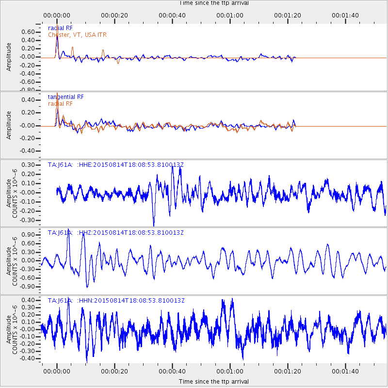
J61A Chester, VT, USA - Earthquake Result Viewer
*The percent match for this event was below the threshold and hence no stack was calculated.
| Earthquake location: |
Northern Mid-Atlantic Ridge |
| Earthquake latitude/longitude: |
21.1/-45.9 |
| Earthquake time(UTC): |
2015/08/14 (226) 18:03:03 GMT |
| Earthquake Depth: |
13 km |
| Earthquake Magnitude: |
5.5 MB |
| Earthquake Catalog/Contributor: |
NEIC PDE/NEIC COMCAT |
|
| Network: |
TA USArray Transportable Network (new EarthScope stations) |
| Station: |
J61A Chester, VT, USA |
| Lat/Lon: |
43.35 N/72.55 W |
| Elevation: |
253 m |
|
| Distance: |
31.4 deg |
| Az: |
321.05 deg |
| Baz: |
126.431 deg |
| Ray Param: |
$rayparam |
*The percent match for this event was below the threshold and hence was not used in the summary stack. |
|
| Radial Match: |
78.56095 % |
| Radial Bump: |
400 |
| Transverse Match: |
59.216793 % |
| Transverse Bump: |
400 |
| SOD ConfigId: |
7422571 |
| Insert Time: |
2019-04-20 10:17:46.621 +0000 |
| GWidth: |
2.5 |
| Max Bumps: |
400 |
| Tol: |
0.001 |
|
Signal To Noise
| Channel | StoN | STA | LTA |
| TA:J61A: :HHZ:20150814T18:08:53.810013Z | 2.6748922 | 3.8436198E-7 | 1.4369252E-7 |
| TA:J61A: :HHN:20150814T18:08:53.810013Z | 1.9497187 | 1.8655011E-7 | 9.568053E-8 |
| TA:J61A: :HHE:20150814T18:08:53.810013Z | 2.8331614 | 1.2101287E-7 | 4.2713022E-8 |
| Arrivals |
| Ps | |
| PpPs | |
| PsPs/PpSs | |


