You are here: Home > Network List > UW - Pacific Northwest Regional Seismic Network Stations List
> Station GNW Green Mountain (BB) > Earthquake Result Viewer
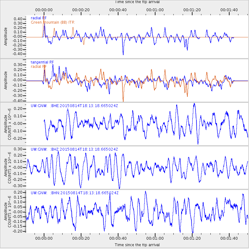
GNW Green Mountain (BB) - Earthquake Result Viewer
*The percent match for this event was below the threshold and hence no stack was calculated.
| Earthquake location: |
Northern Mid-Atlantic Ridge |
| Earthquake latitude/longitude: |
21.1/-45.9 |
| Earthquake time(UTC): |
2015/08/14 (226) 18:03:03 GMT |
| Earthquake Depth: |
13 km |
| Earthquake Magnitude: |
5.5 MB |
| Earthquake Catalog/Contributor: |
NEIC PDE/NEIC COMCAT |
|
| Network: |
UW Pacific Northwest Regional Seismic Network |
| Station: |
GNW Green Mountain (BB) |
| Lat/Lon: |
47.56 N/122.83 W |
| Elevation: |
160 m |
|
| Distance: |
66.0 deg |
| Az: |
313.779 deg |
| Baz: |
84.513 deg |
| Ray Param: |
$rayparam |
*The percent match for this event was below the threshold and hence was not used in the summary stack. |
|
| Radial Match: |
63.21088 % |
| Radial Bump: |
352 |
| Transverse Match: |
51.528683 % |
| Transverse Bump: |
400 |
| SOD ConfigId: |
7422571 |
| Insert Time: |
2019-04-20 10:19:18.938 +0000 |
| GWidth: |
2.5 |
| Max Bumps: |
400 |
| Tol: |
0.001 |
|
Signal To Noise
| Channel | StoN | STA | LTA |
| UW:GNW: :BHZ:20150814T18:13:18.665024Z | 1.3438635 | 1.1785027E-7 | 8.769512E-8 |
| UW:GNW: :BHN:20150814T18:13:18.665024Z | 0.6317257 | 5.2906408E-8 | 8.3749015E-8 |
| UW:GNW: :BHE:20150814T18:13:18.665024Z | 0.5374314 | 4.819268E-8 | 8.9672234E-8 |
| Arrivals |
| Ps | |
| PpPs | |
| PsPs/PpSs | |


