CCM Cathedral Cave, Missouri, USA - Earthquake Result Viewer
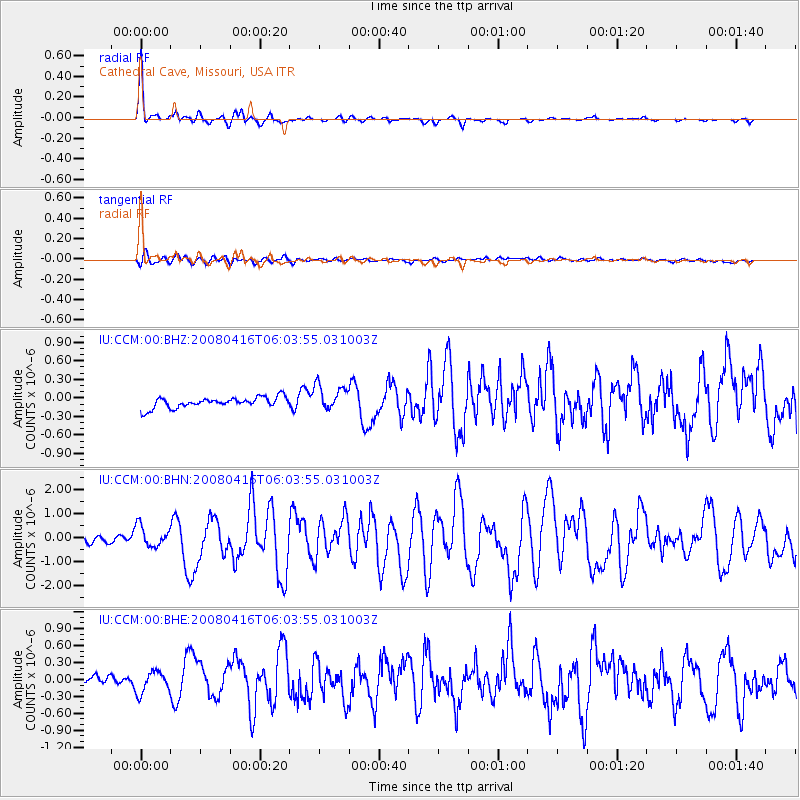
Earthquake location: Andreanof Islands, Aleutian Is.
Earthquake latitude/longitude: 51.9/-179.2
Earthquake time(UTC): 2008/04/16 (107) 05:54:19 GMT
Earthquake Depth: 13 km
Earthquake Magnitude: 6.1 MB, 6.5 MS, 6.6 MW, 6.6 MW
Earthquake Catalog/Contributor: WHDF/NEIC
Network: IU Global Seismograph Network (GSN - IRIS/USGS)
Station: CCM Cathedral Cave, Missouri, USA
Lat/Lon: 38.06 N/91.24 W
Elevation: 222 m
Distance: 60.0 deg
Az: 65.588 deg
Baz: 314.352 deg
Ray Param: 0.06178921
Estimated Moho Depth: 40.0 km
Estimated Crust Vp/Vs: 1.71
Assumed Crust Vp: 6.498 km/s
Estimated Crust Vs: 3.811 km/s
Estimated Crust Poisson's Ratio: 0.24
Radial Match: 94.20275 %
Radial Bump: 300
Transverse Match: 65.97405 %
Transverse Bump: 400
SOD ConfigId: 2504
Insert Time: 2010-03-04 15:39:56.818 +0000
GWidth: 2.5
Max Bumps: 400
Tol: 0.001

Signal To Noise

ChannelStoNSTALTA
IU:CCM:00:BHN:20080416T06:03:55.031003Z3.01714044.3364034E-71.4372561E-7
IU:CCM:00:BHE:20080416T06:03:55.031003Z1.49002151.9233413E-71.2908146E-7
IU:CCM:00:BHZ:20080416T06:03:55.031003Z2.43656642.1208005E-78.704054E-8
Arrivals
Ps4.6 SECOND
PpPs16 SECOND
PsPs/PpSs20 SECOND