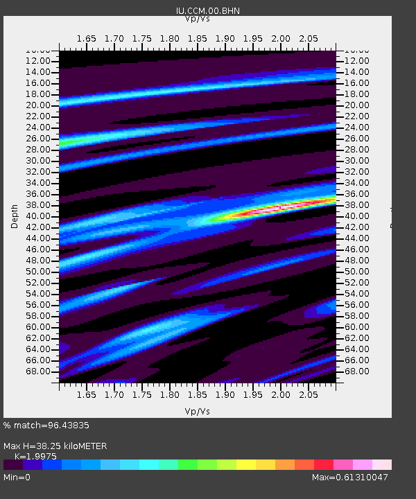
CCM Cathedral Cave, Missouri, USA - Earthquake Result Viewer
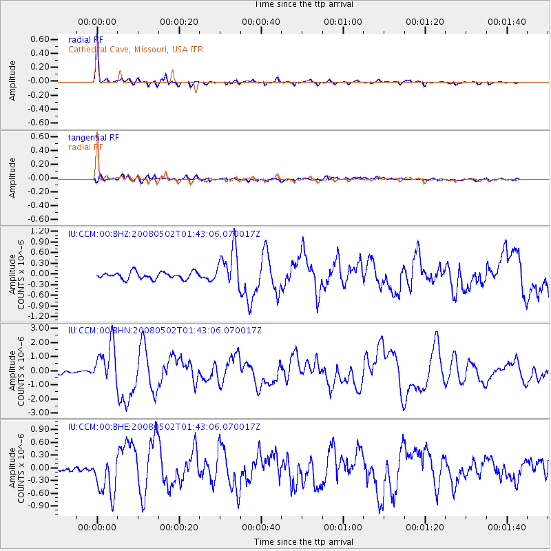
Earthquake location: Andreanof Islands, Aleutian Is.
Earthquake latitude/longitude: 51.9/-177.5
Earthquake time(UTC): 2008/05/02 (123) 01:33:37 GMT
Earthquake Depth: 14 km
Earthquake Magnitude: 6.3 MB, 6.8 MS, 6.6 MW, 6.6 MW
Earthquake Catalog/Contributor: WHDF/NEIC
Network: IU Global Seismograph Network (GSN - IRIS/USGS)
Station: CCM Cathedral Cave, Missouri, USA
Lat/Lon: 38.06 N/91.24 W
Elevation: 222 m
Distance: 59.1 deg
Az: 66.624 deg
Baz: 313.86 deg
Ray Param: 0.062393025
Estimated Moho Depth: 38.25 km
Estimated Crust Vp/Vs: 2.00
Assumed Crust Vp: 6.498 km/s
Estimated Crust Vs: 3.253 km/s
Estimated Crust Poisson's Ratio: 0.33
Radial Match: 96.43835 %
Radial Bump: 275
Transverse Match: 74.764275 %
Transverse Bump: 400
SOD ConfigId: 2504
Insert Time: 2010-03-04 15:39:57.906 +0000
GWidth: 2.5
Max Bumps: 400
Tol: 0.001

Signal To Noise

ChannelStoNSTALTA
IU:CCM:00:BHN:20080502T01:43:06.070017Z13.3664991.4537209E-61.0875854E-7
IU:CCM:00:BHE:20080502T01:43:06.070017Z6.93015054.8188946E-76.953521E-8
IU:CCM:00:BHZ:20080502T01:43:06.070017Z5.793275.6481116E-79.749436E-8
Arrivals
Ps6.1 SECOND
PpPs17 SECOND
PsPs/PpSs23 SECOND