You are here: Home > Network List > CI - Caltech Regional Seismic Network Stations List
> Station GLA Glamis, Glamis, CA, USA > Earthquake Result Viewer
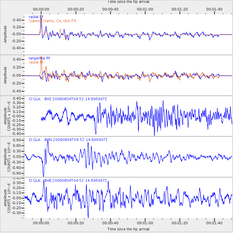
GLA Glamis, Glamis, CA, USA - Earthquake Result Viewer
*The percent match for this event was below the threshold and hence no stack was calculated.
| Earthquake location: |
Kuril Islands |
| Earthquake latitude/longitude: |
49.9/156.4 |
| Earthquake time(UTC): |
2008/08/04 (217) 04:42:14 GMT |
| Earthquake Depth: |
77 km |
| Earthquake Magnitude: |
5.6 MB, 5.8 MW, 5.7 MW |
| Earthquake Catalog/Contributor: |
WHDF/NEIC |
|
| Network: |
CI Caltech Regional Seismic Network |
| Station: |
GLA Glamis, Glamis, CA, USA |
| Lat/Lon: |
33.05 N/114.83 W |
| Elevation: |
610 m |
|
| Distance: |
64.8 deg |
| Az: |
68.08 deg |
| Baz: |
314.356 deg |
| Ray Param: |
$rayparam |
*The percent match for this event was below the threshold and hence was not used in the summary stack. |
|
| Radial Match: |
68.834366 % |
| Radial Bump: |
400 |
| Transverse Match: |
61.87237 % |
| Transverse Bump: |
400 |
| SOD ConfigId: |
2504 |
| Insert Time: |
2010-02-25 23:37:00.389 +0000 |
| GWidth: |
2.5 |
| Max Bumps: |
400 |
| Tol: |
0.001 |
|
Signal To Noise
| Channel | StoN | STA | LTA |
| CI:GLA: :BHN:20080804T04:52:14.896997Z | 6.4756675 | 4.847472E-7 | 7.485672E-8 |
| CI:GLA: :BHE:20080804T04:52:14.896997Z | 2.9825606 | 1.5662219E-7 | 5.251266E-8 |
| CI:GLA: :BHZ:20080804T04:52:14.896997Z | 2.2304914 | 1.7193142E-7 | 7.7082305E-8 |
| Arrivals |
| Ps | |
| PpPs | |
| PsPs/PpSs | |


