You are here: Home > Network List > UW - Pacific Northwest Regional Seismic Network Stations List
> Station MRBL Marblemount, WA, USA > Earthquake Result Viewer
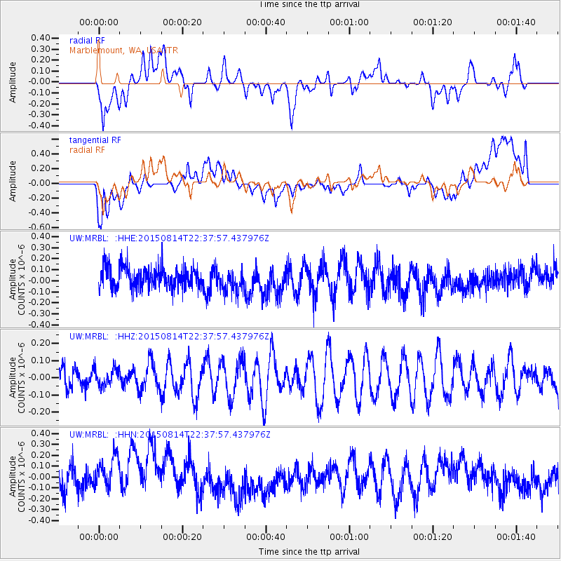
MRBL Marblemount, WA, USA - Earthquake Result Viewer
*The percent match for this event was below the threshold and hence no stack was calculated.
| Earthquake location: |
Solomon Islands |
| Earthquake latitude/longitude: |
-6.2/155.4 |
| Earthquake time(UTC): |
2015/08/14 (226) 22:25:34 GMT |
| Earthquake Depth: |
50 km |
| Earthquake Magnitude: |
4.9 mb |
| Earthquake Catalog/Contributor: |
ISC/ISC |
|
| Network: |
UW Pacific Northwest Regional Seismic Network |
| Station: |
MRBL Marblemount, WA, USA |
| Lat/Lon: |
48.52 N/121.48 W |
| Elevation: |
75 m |
|
| Distance: |
90.0 deg |
| Az: |
41.303 deg |
| Baz: |
260.76 deg |
| Ray Param: |
$rayparam |
*The percent match for this event was below the threshold and hence was not used in the summary stack. |
|
| Radial Match: |
50.93427 % |
| Radial Bump: |
400 |
| Transverse Match: |
50.266655 % |
| Transverse Bump: |
400 |
| SOD ConfigId: |
7422571 |
| Insert Time: |
2019-04-20 10:41:00.876 +0000 |
| GWidth: |
2.5 |
| Max Bumps: |
400 |
| Tol: |
0.001 |
|
Signal To Noise
| Channel | StoN | STA | LTA |
| UW:MRBL: :HHZ:20150814T22:37:57.437976Z | 0.88954616 | 5.120474E-8 | 5.756277E-8 |
| UW:MRBL: :HHN:20150814T22:37:57.437976Z | 1.801315 | 1.9504166E-7 | 1.0827738E-7 |
| UW:MRBL: :HHE:20150814T22:37:57.437976Z | 1.1294684 | 1.0560854E-7 | 9.350287E-8 |
| Arrivals |
| Ps | |
| PpPs | |
| PsPs/PpSs | |


