You are here: Home > Network List > CI - Caltech Regional Seismic Network Stations List
> Station GLA Glamis, Glamis, CA, USA > Earthquake Result Viewer
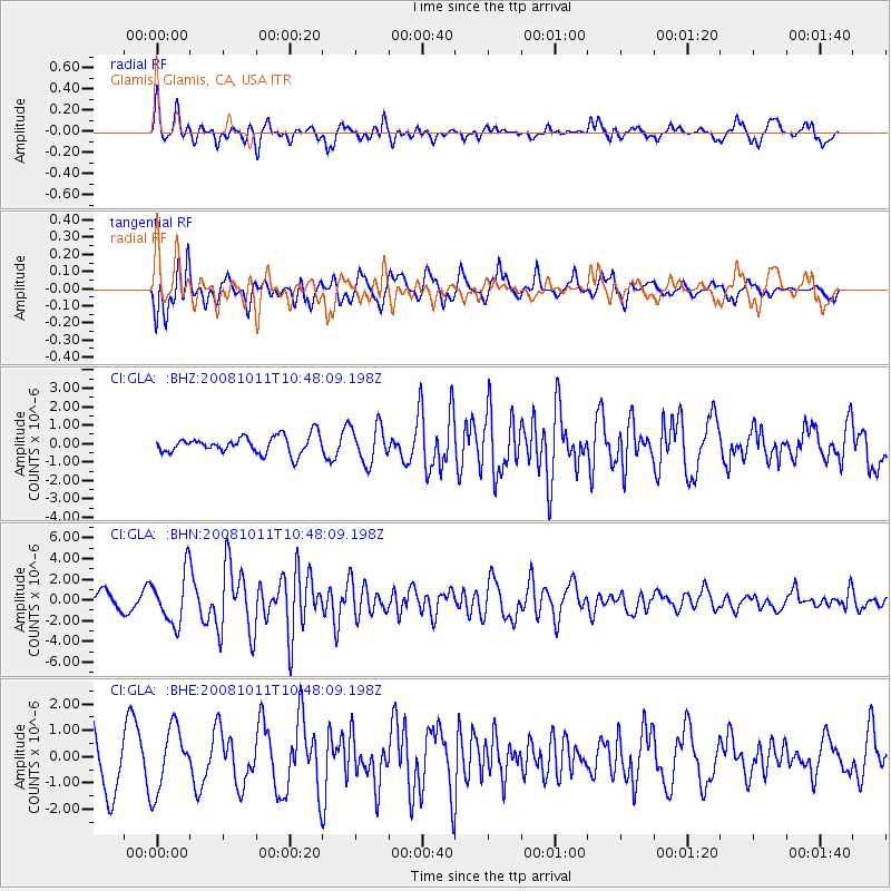
GLA Glamis, Glamis, CA, USA - Earthquake Result Viewer
*The percent match for this event was below the threshold and hence no stack was calculated.
| Earthquake location: |
Virgin Islands |
| Earthquake latitude/longitude: |
19.2/-64.8 |
| Earthquake time(UTC): |
2008/10/11 (285) 10:40:14 GMT |
| Earthquake Depth: |
23 km |
| Earthquake Magnitude: |
6.1 MB, 5.9 MS, 6.1 MW, 6.0 MW |
| Earthquake Catalog/Contributor: |
WHDF/NEIC |
|
| Network: |
CI Caltech Regional Seismic Network |
| Station: |
GLA Glamis, Glamis, CA, USA |
| Lat/Lon: |
33.05 N/114.83 W |
| Elevation: |
610 m |
|
| Distance: |
46.6 deg |
| Az: |
297.646 deg |
| Baz: |
94.411 deg |
| Ray Param: |
$rayparam |
*The percent match for this event was below the threshold and hence was not used in the summary stack. |
|
| Radial Match: |
78.53956 % |
| Radial Bump: |
400 |
| Transverse Match: |
76.991615 % |
| Transverse Bump: |
400 |
| SOD ConfigId: |
2556 |
| Insert Time: |
2010-02-25 23:37:08.230 +0000 |
| GWidth: |
2.5 |
| Max Bumps: |
400 |
| Tol: |
0.001 |
|
Signal To Noise
| Channel | StoN | STA | LTA |
| CI:GLA: :BHN:20081011T10:48:09.198Z | 3.5207765 | 2.4552933E-6 | 6.973726E-7 |
| CI:GLA: :BHE:20081011T10:48:09.198Z | 1.1544068 | 1.1965365E-6 | 1.0364946E-6 |
| CI:GLA: :BHZ:20081011T10:48:09.198Z | 2.1505265 | 9.956593E-7 | 4.62984E-7 |
| Arrivals |
| Ps | |
| PpPs | |
| PsPs/PpSs | |


