You are here: Home > Network List > US - United States National Seismic Network Stations List
> Station GLMI Grayling, Michigan, USA > Earthquake Result Viewer
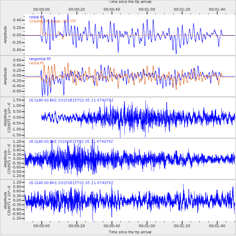
GLMI Grayling, Michigan, USA - Earthquake Result Viewer
*The percent match for this event was below the threshold and hence no stack was calculated.
| Earthquake location: |
Kuril Islands |
| Earthquake latitude/longitude: |
44.2/148.1 |
| Earthquake time(UTC): |
2015/08/15 (227) 01:53:55 GMT |
| Earthquake Depth: |
100 km |
| Earthquake Magnitude: |
3.6 mb |
| Earthquake Catalog/Contributor: |
ISC/ISC |
|
| Network: |
US United States National Seismic Network |
| Station: |
GLMI Grayling, Michigan, USA |
| Lat/Lon: |
44.82 N/84.62 W |
| Elevation: |
387 m |
|
| Distance: |
79.8 deg |
| Az: |
35.116 deg |
| Baz: |
324.453 deg |
| Ray Param: |
$rayparam |
*The percent match for this event was below the threshold and hence was not used in the summary stack. |
|
| Radial Match: |
49.466076 % |
| Radial Bump: |
400 |
| Transverse Match: |
53.17343 % |
| Transverse Bump: |
400 |
| SOD ConfigId: |
7422571 |
| Insert Time: |
2019-04-20 10:49:37.657 +0000 |
| GWidth: |
2.5 |
| Max Bumps: |
400 |
| Tol: |
0.001 |
|
Signal To Noise
| Channel | StoN | STA | LTA |
| US:GLMI:00:BHZ:20150815T02:05:21.674976Z | 2.0531118 | 2.9078888E-7 | 1.4163324E-7 |
| US:GLMI:00:BH1:20150815T02:05:21.674976Z | 1.3198825 | 2.9882068E-7 | 2.2639946E-7 |
| US:GLMI:00:BH2:20150815T02:05:21.674976Z | 1.5004529 | 3.2637996E-7 | 2.1752098E-7 |
| Arrivals |
| Ps | |
| PpPs | |
| PsPs/PpSs | |


