You are here: Home > Network List > CI - Caltech Regional Seismic Network Stations List
> Station GLA Glamis, Glamis, CA, USA > Earthquake Result Viewer
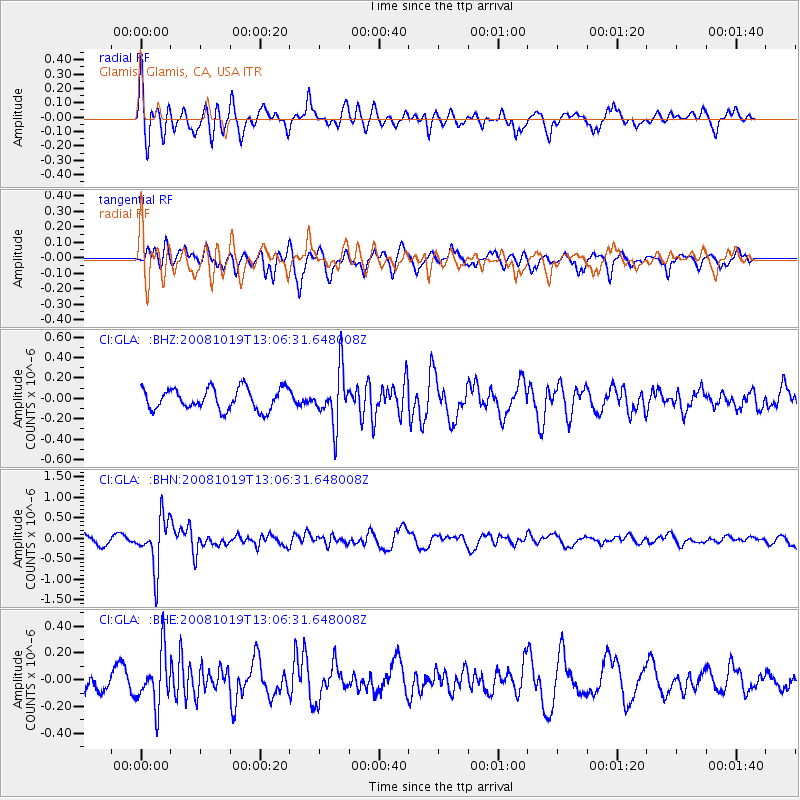
GLA Glamis, Glamis, CA, USA - Earthquake Result Viewer
*The percent match for this event was below the threshold and hence no stack was calculated.
| Earthquake location: |
Tonga Islands |
| Earthquake latitude/longitude: |
-22.0/-173.7 |
| Earthquake time(UTC): |
2008/10/19 (293) 12:55:05 GMT |
| Earthquake Depth: |
35 km |
| Earthquake Magnitude: |
5.7 MB, 5.3 MS, 5.6 MW, 5.5 MW |
| Earthquake Catalog/Contributor: |
WHDF/NEIC |
|
| Network: |
CI Caltech Regional Seismic Network |
| Station: |
GLA Glamis, Glamis, CA, USA |
| Lat/Lon: |
33.05 N/114.83 W |
| Elevation: |
610 m |
|
| Distance: |
78.4 deg |
| Az: |
47.216 deg |
| Baz: |
234.209 deg |
| Ray Param: |
$rayparam |
*The percent match for this event was below the threshold and hence was not used in the summary stack. |
|
| Radial Match: |
56.9423 % |
| Radial Bump: |
368 |
| Transverse Match: |
64.34033 % |
| Transverse Bump: |
381 |
| SOD ConfigId: |
2556 |
| Insert Time: |
2010-02-25 23:37:09.143 +0000 |
| GWidth: |
2.5 |
| Max Bumps: |
400 |
| Tol: |
0.001 |
|
Signal To Noise
| Channel | StoN | STA | LTA |
| CI:GLA: :BHN:20081019T13:06:31.648008Z | 5.906804 | 6.199227E-7 | 1.0495061E-7 |
| CI:GLA: :BHE:20081019T13:06:31.648008Z | 1.6142838 | 1.9744915E-7 | 1.2231378E-7 |
| CI:GLA: :BHZ:20081019T13:06:31.648008Z | 2.471036 | 2.597035E-7 | 1.0509904E-7 |
| Arrivals |
| Ps | |
| PpPs | |
| PsPs/PpSs | |


