CCM Cathedral Cave, Missouri, USA - Earthquake Result Viewer
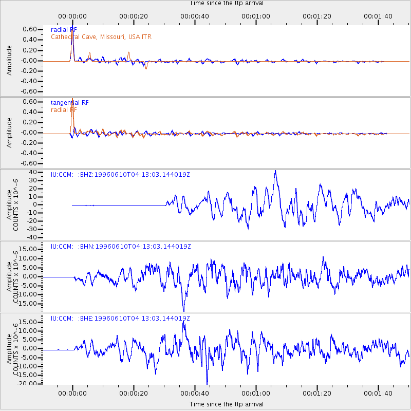
Earthquake location: Andreanof Islands, Aleutian Is.
Earthquake latitude/longitude: 51.6/-177.6
Earthquake time(UTC): 1996/06/10 (162) 04:03:35 GMT
Earthquake Depth: 33 km
Earthquake Magnitude: 6.6 MB, 7.6 MS, 7.9 UNKNOWN, 7.4 MS
Earthquake Catalog/Contributor: WHDF/NEIC
Network: IU Global Seismograph Network (GSN - IRIS/USGS)
Station: CCM Cathedral Cave, Missouri, USA
Lat/Lon: 38.06 N/91.24 W
Elevation: 222 m
Distance: 59.3 deg
Az: 66.393 deg
Baz: 313.569 deg
Ray Param: 0.0622261
Estimated Moho Depth: 26.25 km
Estimated Crust Vp/Vs: 1.60
Assumed Crust Vp: 6.498 km/s
Estimated Crust Vs: 4.061 km/s
Estimated Crust Poisson's Ratio: 0.18
Radial Match: 97.6347 %
Radial Bump: 324
Transverse Match: 91.90121 %
Transverse Bump: 400
SOD ConfigId: 6273
Insert Time: 2010-03-04 15:44:28.028 +0000
GWidth: 2.5
Max Bumps: 400
Tol: 0.001

Signal To Noise

ChannelStoNSTALTA
IU:CCM: :BHN:19960610T04:13:03.144019Z19.1868951.6906076E-68.811262E-8
IU:CCM: :BHE:19960610T04:13:03.144019Z21.6206682.0524274E-69.492896E-8
IU:CCM: :BHZ:19960610T04:13:03.144019Z29.98595.1188213E-61.7070761E-7
Arrivals
Ps2.6 SECOND
PpPs9.9 SECOND
PsPs/PpSs13 SECOND