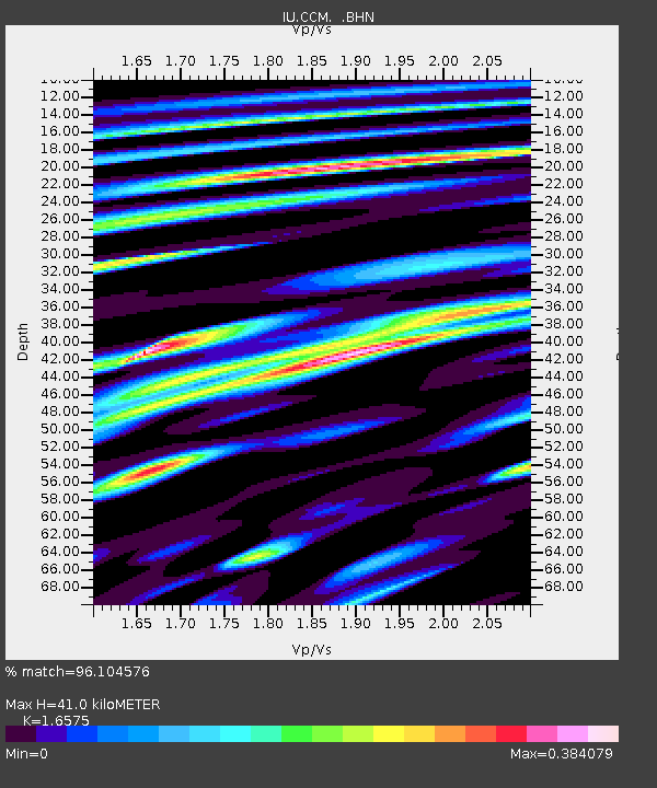
CCM Cathedral Cave, Missouri, USA - Earthquake Result Viewer

Earthquake location: Andreanof Islands, Aleutian Is.
Earthquake latitude/longitude: 51.5/-178.1
Earthquake time(UTC): 1996/06/08 (160) 23:19:15 GMT
Earthquake Depth: 33 km
Earthquake Magnitude: 5.9 MB, 6.3 MS, 6.5 UNKNOWN, 6.1 MS
Earthquake Catalog/Contributor: WHDF/NEIC
Network: IU Global Seismograph Network (GSN - IRIS/USGS)
Station: CCM Cathedral Cave, Missouri, USA
Lat/Lon: 38.06 N/91.24 W
Elevation: 222 m
Distance: 59.6 deg
Az: 66.04 deg
Baz: 313.637 deg
Ray Param: 0.062019944
Estimated Moho Depth: 41.0 km
Estimated Crust Vp/Vs: 1.66
Assumed Crust Vp: 6.498 km/s
Estimated Crust Vs: 3.92 km/s
Estimated Crust Poisson's Ratio: 0.21
Radial Match: 96.104576 %
Radial Bump: 382
Transverse Match: 82.85529 %
Transverse Bump: 400
SOD ConfigId: 6273
Insert Time: 2010-03-04 15:44:29.488 +0000
GWidth: 2.5
Max Bumps: 400
Tol: 0.001

Signal To Noise

ChannelStoNSTALTA
IU:CCM: :BHN:19960608T23:28:44.967004Z10.2225814.90804E-74.801175E-8
IU:CCM: :BHE:19960608T23:28:44.967004Z13.6965725.7172093E-74.17419E-8
IU:CCM: :BHZ:19960608T23:28:44.967004Z24.907851.5172253E-66.0913536E-8
Arrivals
Ps4.4 SECOND
PpPs16 SECOND
PsPs/PpSs20 SECOND