You are here: Home > Network List > CI - Caltech Regional Seismic Network Stations List
> Station SMM Simmler, CA, USA > Earthquake Result Viewer
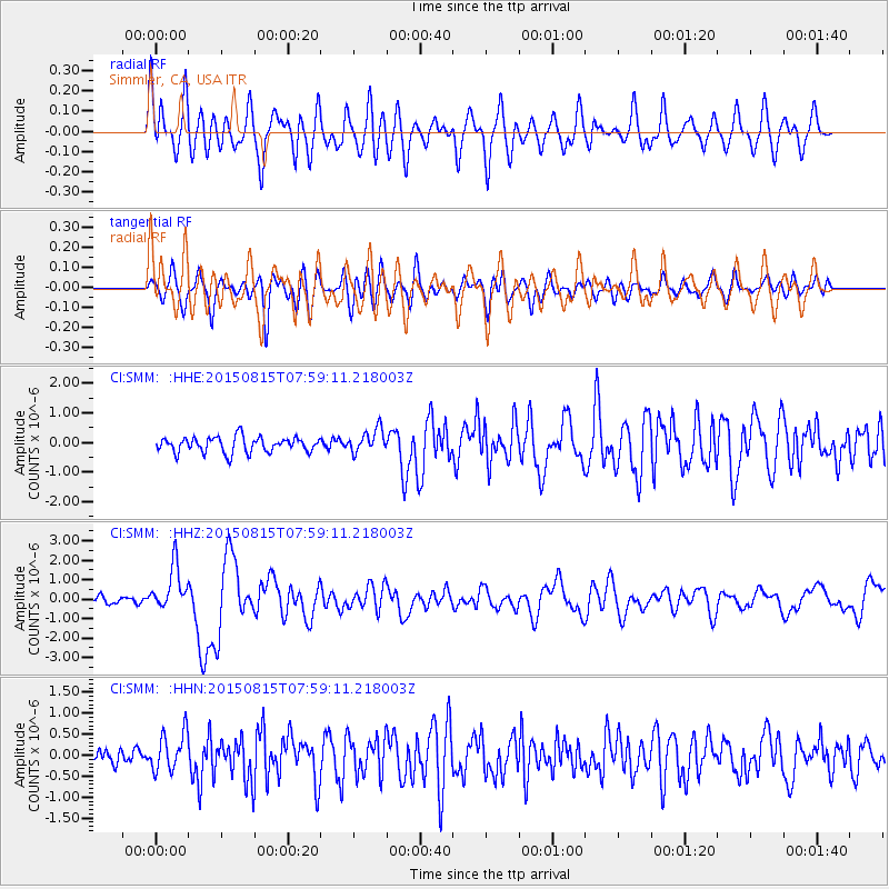
SMM Simmler, CA, USA - Earthquake Result Viewer
*The percent match for this event was below the threshold and hence no stack was calculated.
| Earthquake location: |
Solomon Islands |
| Earthquake latitude/longitude: |
-10.9/163.9 |
| Earthquake time(UTC): |
2015/08/15 (227) 07:47:06 GMT |
| Earthquake Depth: |
6.4 km |
| Earthquake Magnitude: |
6.6 MWP, 6.6 MI |
| Earthquake Catalog/Contributor: |
NEIC PDE/NEIC COMCAT |
|
| Network: |
CI Caltech Regional Seismic Network |
| Station: |
SMM Simmler, CA, USA |
| Lat/Lon: |
35.31 N/120.00 W |
| Elevation: |
599 m |
|
| Distance: |
85.2 deg |
| Az: |
52.827 deg |
| Baz: |
253.126 deg |
| Ray Param: |
$rayparam |
*The percent match for this event was below the threshold and hence was not used in the summary stack. |
|
| Radial Match: |
78.74212 % |
| Radial Bump: |
400 |
| Transverse Match: |
65.5504 % |
| Transverse Bump: |
400 |
| SOD ConfigId: |
7422571 |
| Insert Time: |
2019-04-20 10:56:01.741 +0000 |
| GWidth: |
2.5 |
| Max Bumps: |
400 |
| Tol: |
0.001 |
|
Signal To Noise
| Channel | StoN | STA | LTA |
| CI:SMM: :HHZ:20150815T07:59:11.218003Z | 6.050917 | 1.1362268E-6 | 1.8777763E-7 |
| CI:SMM: :HHN:20150815T07:59:11.218003Z | 1.4804751 | 4.5988753E-7 | 3.106351E-7 |
| CI:SMM: :HHE:20150815T07:59:11.218003Z | 1.5998589 | 4.1470446E-7 | 2.5921312E-7 |
| Arrivals |
| Ps | |
| PpPs | |
| PsPs/PpSs | |


