You are here: Home > Network List > CI - Caltech Regional Seismic Network Stations List
> Station GLA Glamis, Glamis, CA, USA > Earthquake Result Viewer
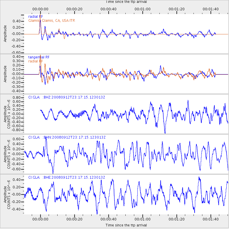
GLA Glamis, Glamis, CA, USA - Earthquake Result Viewer
*The percent match for this event was below the threshold and hence no stack was calculated.
| Earthquake location: |
Komandorskiye Ostrova Region |
| Earthquake latitude/longitude: |
56.3/164.1 |
| Earthquake time(UTC): |
2008/09/12 (256) 23:07:50 GMT |
| Earthquake Depth: |
9.3 km |
| Earthquake Magnitude: |
5.5 MB, 5.7 MS, 5.9 MW, 5.9 MW |
| Earthquake Catalog/Contributor: |
WHDF/NEIC |
|
| Network: |
CI Caltech Regional Seismic Network |
| Station: |
GLA Glamis, Glamis, CA, USA |
| Lat/Lon: |
33.05 N/114.83 W |
| Elevation: |
610 m |
|
| Distance: |
58.5 deg |
| Az: |
76.81 deg |
| Baz: |
319.751 deg |
| Ray Param: |
$rayparam |
*The percent match for this event was below the threshold and hence was not used in the summary stack. |
|
| Radial Match: |
52.254795 % |
| Radial Bump: |
340 |
| Transverse Match: |
40.117386 % |
| Transverse Bump: |
363 |
| SOD ConfigId: |
2560 |
| Insert Time: |
2010-02-25 23:37:15.219 +0000 |
| GWidth: |
2.5 |
| Max Bumps: |
400 |
| Tol: |
0.001 |
|
Signal To Noise
| Channel | StoN | STA | LTA |
| CI:GLA: :BHN:20080912T23:17:15.123013Z | 1.8413177 | 2.517186E-7 | 1.3670568E-7 |
| CI:GLA: :BHE:20080912T23:17:15.123013Z | 1.5410094 | 2.0058894E-7 | 1.3016724E-7 |
| CI:GLA: :BHZ:20080912T23:17:15.123013Z | 1.8282032 | 2.5182595E-7 | 1.3774505E-7 |
| Arrivals |
| Ps | |
| PpPs | |
| PsPs/PpSs | |


