You are here: Home > Network List > TA - USArray Transportable Network (new EarthScope stations) Stations List
> Station G05D Wamic, OR, USA > Earthquake Result Viewer
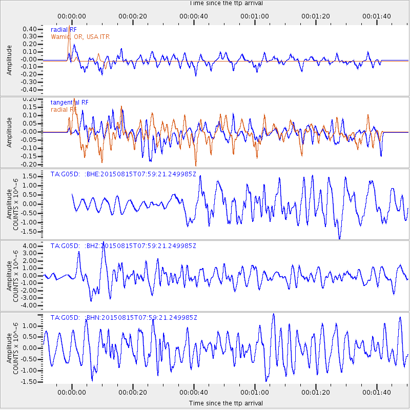
G05D Wamic, OR, USA - Earthquake Result Viewer
*The percent match for this event was below the threshold and hence no stack was calculated.
| Earthquake location: |
Solomon Islands |
| Earthquake latitude/longitude: |
-10.9/163.9 |
| Earthquake time(UTC): |
2015/08/15 (227) 07:47:06 GMT |
| Earthquake Depth: |
6.4 km |
| Earthquake Magnitude: |
6.6 MWP, 6.6 MI |
| Earthquake Catalog/Contributor: |
NEIC PDE/NEIC COMCAT |
|
| Network: |
TA USArray Transportable Network (new EarthScope stations) |
| Station: |
G05D Wamic, OR, USA |
| Lat/Lon: |
45.24 N/121.32 W |
| Elevation: |
592 m |
|
| Distance: |
87.2 deg |
| Az: |
43.048 deg |
| Baz: |
251.619 deg |
| Ray Param: |
$rayparam |
*The percent match for this event was below the threshold and hence was not used in the summary stack. |
|
| Radial Match: |
72.866806 % |
| Radial Bump: |
400 |
| Transverse Match: |
51.679405 % |
| Transverse Bump: |
400 |
| SOD ConfigId: |
7422571 |
| Insert Time: |
2019-04-20 10:59:39.541 +0000 |
| GWidth: |
2.5 |
| Max Bumps: |
400 |
| Tol: |
0.001 |
|
Signal To Noise
| Channel | StoN | STA | LTA |
| TA:G05D: :BHZ:20150815T07:59:21.249985Z | 6.1544857 | 1.1967196E-6 | 1.9444674E-7 |
| TA:G05D: :BHN:20150815T07:59:21.249985Z | 1.9347076 | 6.3597486E-7 | 3.2871884E-7 |
| TA:G05D: :BHE:20150815T07:59:21.249985Z | 1.3256679 | 3.3983488E-7 | 2.5634995E-7 |
| Arrivals |
| Ps | |
| PpPs | |
| PsPs/PpSs | |


