You are here: Home > Network List > TA - USArray Transportable Network (new EarthScope stations) Stations List
> Station D62A Allapoint, Allagash, ME, USA > Earthquake Result Viewer
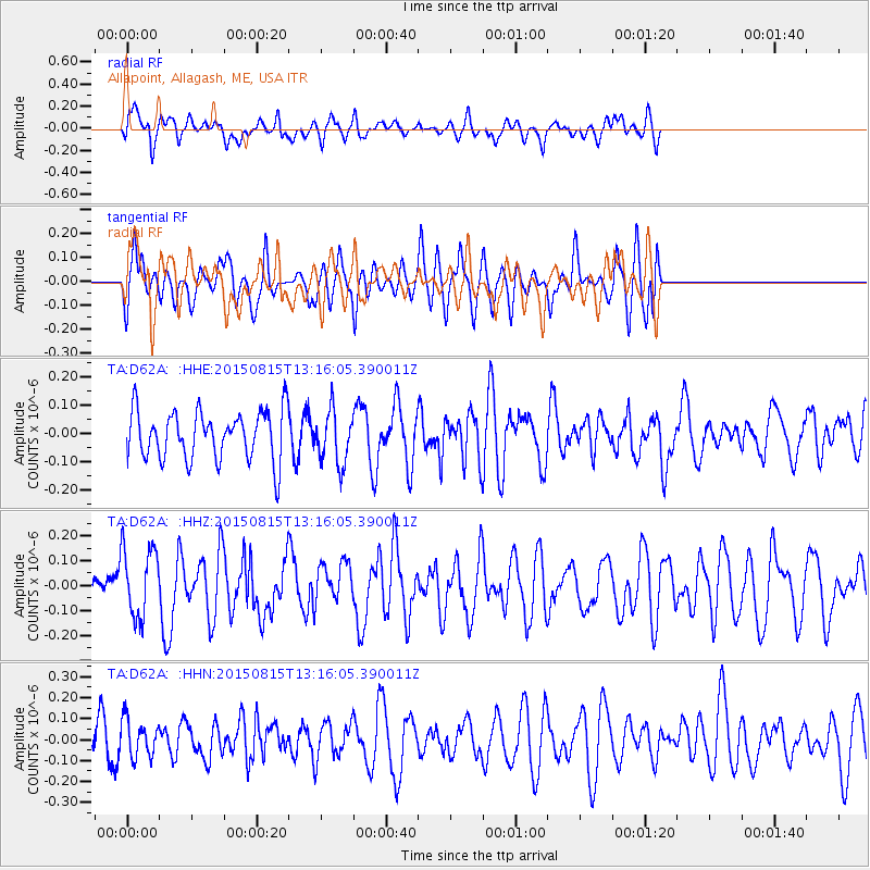
D62A Allapoint, Allagash, ME, USA - Earthquake Result Viewer
*The percent match for this event was below the threshold and hence no stack was calculated.
| Earthquake location: |
Near Coast Of Guatemala |
| Earthquake latitude/longitude: |
14.0/-91.0 |
| Earthquake time(UTC): |
2015/08/15 (227) 13:09:26 GMT |
| Earthquake Depth: |
73 km |
| Earthquake Magnitude: |
5.1 MW |
| Earthquake Catalog/Contributor: |
ISC/ISC |
|
| Network: |
TA USArray Transportable Network (new EarthScope stations) |
| Station: |
D62A Allapoint, Allagash, ME, USA |
| Lat/Lon: |
47.08 N/69.05 W |
| Elevation: |
189 m |
|
| Distance: |
37.8 deg |
| Az: |
24.65 deg |
| Baz: |
216.335 deg |
| Ray Param: |
$rayparam |
*The percent match for this event was below the threshold and hence was not used in the summary stack. |
|
| Radial Match: |
57.293823 % |
| Radial Bump: |
400 |
| Transverse Match: |
47.072514 % |
| Transverse Bump: |
400 |
| SOD ConfigId: |
7422571 |
| Insert Time: |
2019-04-20 11:13:09.374 +0000 |
| GWidth: |
2.5 |
| Max Bumps: |
400 |
| Tol: |
0.001 |
|
Signal To Noise
| Channel | StoN | STA | LTA |
| TA:D62A: :HHZ:20150815T13:16:05.390011Z | 2.040911 | 1.4187964E-7 | 6.9517796E-8 |
| TA:D62A: :HHN:20150815T13:16:05.390011Z | 0.8416165 | 8.823161E-8 | 1.0483588E-7 |
| TA:D62A: :HHE:20150815T13:16:05.390011Z | 1.0881555 | 9.391885E-8 | 8.631014E-8 |
| Arrivals |
| Ps | |
| PpPs | |
| PsPs/PpSs | |


