You are here: Home > Network List > TA - USArray Transportable Network (new EarthScope stations) Stations List
> Station J62A Henniker, NH, USA > Earthquake Result Viewer
J62A Henniker, NH, USA - Earthquake Result Viewer
*The percent match for this event was below the threshold and hence no stack was calculated.
| Earthquake location: |
Near Coast Of Guatemala |
| Earthquake latitude/longitude: |
14.0/-91.0 |
| Earthquake time(UTC): |
2015/08/15 (227) 13:09:26 GMT |
| Earthquake Depth: |
73 km |
| Earthquake Magnitude: |
5.1 MW |
| Earthquake Catalog/Contributor: |
ISC/ISC |
|
| Network: |
TA USArray Transportable Network (new EarthScope stations) |
| Station: |
J62A Henniker, NH, USA |
| Lat/Lon: |
43.23 N/71.81 W |
| Elevation: |
266 m |
|
| Distance: |
33.5 deg |
| Az: |
25.802 deg |
| Baz: |
215.318 deg |
| Ray Param: |
$rayparam |
*The percent match for this event was below the threshold and hence was not used in the summary stack. |
|
| Radial Match: |
51.89404 % |
| Radial Bump: |
400 |
| Transverse Match: |
61.083984 % |
| Transverse Bump: |
400 |
| SOD ConfigId: |
7422571 |
| Insert Time: |
2019-04-20 11:13:23.592 +0000 |
| GWidth: |
2.5 |
| Max Bumps: |
400 |
| Tol: |
0.001 |
|
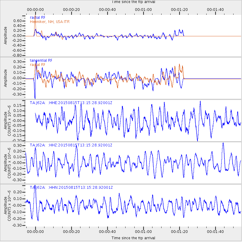
Signal To Noise
| Channel | StoN | STA | LTA |
| TA:J62A: :HHZ:20150815T13:15:28.92001Z | 1.6540964 | 1.400669E-7 | 8.467881E-8 |
| TA:J62A: :HHN:20150815T13:15:28.92001Z | 1.6493459 | 1.4510626E-7 | 8.7978066E-8 |
| TA:J62A: :HHE:20150815T13:15:28.92001Z | 1.0949451 | 7.1156045E-8 | 6.498595E-8 |
| Arrivals |
| Ps | |
| PpPs | |
| PsPs/PpSs | |


