You are here: Home > Network List > US - United States National Seismic Network Stations List
> Station MSO Missoula, Montana, USA > Earthquake Result Viewer
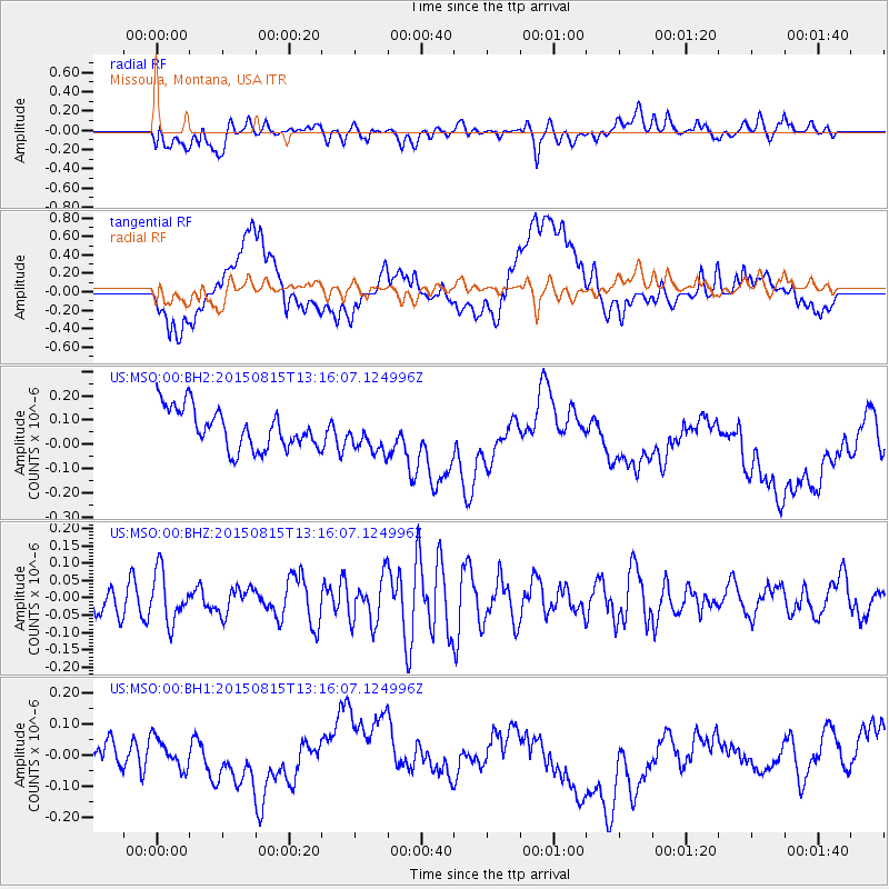
MSO Missoula, Montana, USA - Earthquake Result Viewer
*The percent match for this event was below the threshold and hence no stack was calculated.
| Earthquake location: |
Near Coast Of Guatemala |
| Earthquake latitude/longitude: |
14.0/-91.0 |
| Earthquake time(UTC): |
2015/08/15 (227) 13:09:26 GMT |
| Earthquake Depth: |
73 km |
| Earthquake Magnitude: |
5.1 MW |
| Earthquake Catalog/Contributor: |
ISC/ISC |
|
| Network: |
US United States National Seismic Network |
| Station: |
MSO Missoula, Montana, USA |
| Lat/Lon: |
46.83 N/113.94 W |
| Elevation: |
1264 m |
|
| Distance: |
38.0 deg |
| Az: |
334.228 deg |
| Baz: |
142.065 deg |
| Ray Param: |
$rayparam |
*The percent match for this event was below the threshold and hence was not used in the summary stack. |
|
| Radial Match: |
43.452667 % |
| Radial Bump: |
400 |
| Transverse Match: |
25.645102 % |
| Transverse Bump: |
400 |
| SOD ConfigId: |
7422571 |
| Insert Time: |
2019-04-20 11:14:17.597 +0000 |
| GWidth: |
2.5 |
| Max Bumps: |
400 |
| Tol: |
0.001 |
|
Signal To Noise
| Channel | StoN | STA | LTA |
| US:MSO:00:BHZ:20150815T13:16:07.124996Z | 1.3825972 | 7.2747945E-8 | 5.2616873E-8 |
| US:MSO:00:BH1:20150815T13:16:07.124996Z | 0.83298683 | 6.3153706E-8 | 7.581597E-8 |
| US:MSO:00:BH2:20150815T13:16:07.124996Z | 0.89335716 | 7.3549955E-8 | 8.232984E-8 |
| Arrivals |
| Ps | |
| PpPs | |
| PsPs/PpSs | |


