You are here: Home > Network List > IU - Global Seismograph Network (GSN - IRIS/USGS) Stations List
> Station CCM Cathedral Cave, Missouri, USA > Earthquake Result Viewer
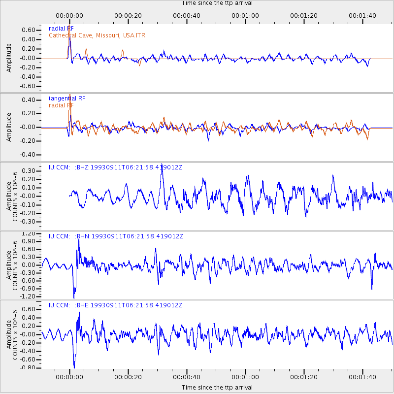
CCM Cathedral Cave, Missouri, USA - Earthquake Result Viewer
*The percent match for this event was below the threshold and hence no stack was calculated.
| Earthquake location: |
Northern Peru |
| Earthquake latitude/longitude: |
-4.7/-76.3 |
| Earthquake time(UTC): |
1993/09/11 (254) 06:14:27 GMT |
| Earthquake Depth: |
121 km |
| Earthquake Magnitude: |
5.6 MB, 5.8 UNKNOWN |
| Earthquake Catalog/Contributor: |
WHDF/NEIC |
|
| Network: |
IU Global Seismograph Network (GSN - IRIS/USGS) |
| Station: |
CCM Cathedral Cave, Missouri, USA |
| Lat/Lon: |
38.06 N/91.24 W |
| Elevation: |
222 m |
|
| Distance: |
44.7 deg |
| Az: |
343.202 deg |
| Baz: |
158.598 deg |
| Ray Param: |
$rayparam |
*The percent match for this event was below the threshold and hence was not used in the summary stack. |
|
| Radial Match: |
60.021477 % |
| Radial Bump: |
400 |
| Transverse Match: |
63.492443 % |
| Transverse Bump: |
400 |
| SOD ConfigId: |
4480 |
| Insert Time: |
2010-03-04 15:47:47.172 +0000 |
| GWidth: |
2.5 |
| Max Bumps: |
400 |
| Tol: |
0.001 |
|
Signal To Noise
| Channel | StoN | STA | LTA |
| IU:CCM: :BHN:19930911T06:21:58.419012Z | 3.1287339 | 4.907949E-7 | 1.5686693E-7 |
| IU:CCM: :BHE:19930911T06:21:58.419012Z | 4.464615 | 3.0209245E-7 | 6.766372E-8 |
| IU:CCM: :BHZ:19930911T06:21:58.419012Z | 2.2841296 | 1.4867446E-7 | 6.5090205E-8 |
| Arrivals |
| Ps | |
| PpPs | |
| PsPs/PpSs | |


