You are here: Home > Network List > IU - Global Seismograph Network (GSN - IRIS/USGS) Stations List
> Station CCM Cathedral Cave, Missouri, USA > Earthquake Result Viewer
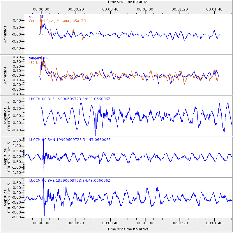
CCM Cathedral Cave, Missouri, USA - Earthquake Result Viewer
*The percent match for this event was below the threshold and hence no stack was calculated.
| Earthquake location: |
Jujuy Province, Argentina |
| Earthquake latitude/longitude: |
-22.8/-66.2 |
| Earthquake time(UTC): |
1999/06/09 (160) 23:25:01 GMT |
| Earthquake Depth: |
250 km |
| Earthquake Magnitude: |
5.5 MW, 5.3 MB |
| Earthquake Catalog/Contributor: |
WHDF/NEIC |
|
| Network: |
IU Global Seismograph Network (GSN - IRIS/USGS) |
| Station: |
CCM Cathedral Cave, Missouri, USA |
| Lat/Lon: |
38.06 N/91.24 W |
| Elevation: |
222 m |
|
| Distance: |
64.9 deg |
| Az: |
338.333 deg |
| Baz: |
154.423 deg |
| Ray Param: |
$rayparam |
*The percent match for this event was below the threshold and hence was not used in the summary stack. |
|
| Radial Match: |
64.91343 % |
| Radial Bump: |
400 |
| Transverse Match: |
76.04095 % |
| Transverse Bump: |
400 |
| SOD ConfigId: |
4480 |
| Insert Time: |
2010-03-04 15:47:51.192 +0000 |
| GWidth: |
2.5 |
| Max Bumps: |
400 |
| Tol: |
0.001 |
|
Signal To Noise
| Channel | StoN | STA | LTA |
| IU:CCM:00:BHN:19990609T23:34:43.066006Z | 2.5450945 | 5.3840546E-7 | 2.1154636E-7 |
| IU:CCM:00:BHE:19990609T23:34:43.066006Z | 1.6479641 | 2.6647302E-7 | 1.6169832E-7 |
| IU:CCM:00:BHZ:19990609T23:34:43.066006Z | 1.2845953 | 2.1688456E-7 | 1.6883494E-7 |
| Arrivals |
| Ps | |
| PpPs | |
| PsPs/PpSs | |


