You are here: Home > Network List > GS - US Geological Survey Networks Stations List
> Station KAN10 Keim Farm > Earthquake Result Viewer
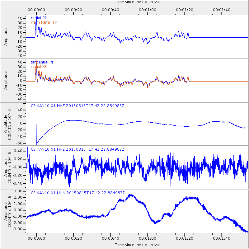
KAN10 Keim Farm - Earthquake Result Viewer
*The percent match for this event was below the threshold and hence no stack was calculated.
| Earthquake location: |
Kermadec Islands Region |
| Earthquake latitude/longitude: |
-27.3/-176.3 |
| Earthquake time(UTC): |
2015/08/15 (227) 17:29:23 GMT |
| Earthquake Depth: |
21 km |
| Earthquake Magnitude: |
5.5 MW |
| Earthquake Catalog/Contributor: |
ISC/ISC |
|
| Network: |
GS US Geological Survey Networks |
| Station: |
KAN10 Keim Farm |
| Lat/Lon: |
37.12 N/98.10 W |
| Elevation: |
417 m |
|
| Distance: |
97.3 deg |
| Az: |
52.067 deg |
| Baz: |
241.457 deg |
| Ray Param: |
$rayparam |
*The percent match for this event was below the threshold and hence was not used in the summary stack. |
|
| Radial Match: |
55.61456 % |
| Radial Bump: |
387 |
| Transverse Match: |
54.35314 % |
| Transverse Bump: |
352 |
| SOD ConfigId: |
7422571 |
| Insert Time: |
2019-04-20 11:18:07.285 +0000 |
| GWidth: |
2.5 |
| Max Bumps: |
400 |
| Tol: |
0.001 |
|
Signal To Noise
| Channel | StoN | STA | LTA |
| GS:KAN10:01:HHZ:20150815T17:42:22.884983Z | 0.86811996 | 1.7171797E-7 | 1.9780444E-7 |
| GS:KAN10:01:HHN:20150815T17:42:22.884983Z | 0.39690116 | 1.5771296E-6 | 3.9736083E-6 |
| GS:KAN10:01:HHE:20150815T17:42:22.884983Z | 0.48532498 | 1.0231625E-5 | 2.1082009E-5 |
| Arrivals |
| Ps | |
| PpPs | |
| PsPs/PpSs | |


