You are here: Home > Network List > IU - Global Seismograph Network (GSN - IRIS/USGS) Stations List
> Station CCM Cathedral Cave, Missouri, USA > Earthquake Result Viewer
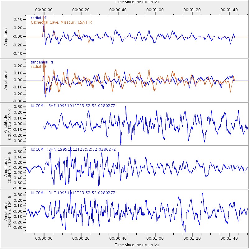
CCM Cathedral Cave, Missouri, USA - Earthquake Result Viewer
*The percent match for this event was below the threshold and hence no stack was calculated.
| Earthquake location: |
Southern East Pacific Rise |
| Earthquake latitude/longitude: |
-35.4/-106.2 |
| Earthquake time(UTC): |
1995/10/12 (285) 23:41:45 GMT |
| Earthquake Depth: |
10 km |
| Earthquake Magnitude: |
5.5 MB, 5.3 MS, 5.9 UNKNOWN |
| Earthquake Catalog/Contributor: |
WHDF/NEIC |
|
| Network: |
IU Global Seismograph Network (GSN - IRIS/USGS) |
| Station: |
CCM Cathedral Cave, Missouri, USA |
| Lat/Lon: |
38.06 N/91.24 W |
| Elevation: |
222 m |
|
| Distance: |
74.4 deg |
| Az: |
12.228 deg |
| Baz: |
192.66 deg |
| Ray Param: |
$rayparam |
*The percent match for this event was below the threshold and hence was not used in the summary stack. |
|
| Radial Match: |
66.76103 % |
| Radial Bump: |
400 |
| Transverse Match: |
67.770164 % |
| Transverse Bump: |
400 |
| SOD ConfigId: |
4480 |
| Insert Time: |
2010-03-04 15:48:01.174 +0000 |
| GWidth: |
2.5 |
| Max Bumps: |
400 |
| Tol: |
0.001 |
|
Signal To Noise
| Channel | StoN | STA | LTA |
| IU:CCM: :BHN:19951012T23:52:52.028027Z | 3.5165112 | 2.9246908E-7 | 8.317024E-8 |
| IU:CCM: :BHE:19951012T23:52:52.028027Z | 1.3994436 | 9.3503594E-8 | 6.6814835E-8 |
| IU:CCM: :BHZ:19951012T23:52:52.028027Z | 1.2991887 | 9.5774574E-8 | 7.371876E-8 |
| Arrivals |
| Ps | |
| PpPs | |
| PsPs/PpSs | |


