You are here: Home > Network List > IU - Global Seismograph Network (GSN - IRIS/USGS) Stations List
> Station CCM Cathedral Cave, Missouri, USA > Earthquake Result Viewer
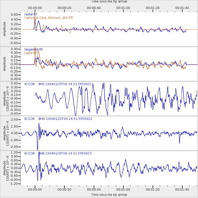
CCM Cathedral Cave, Missouri, USA - Earthquake Result Viewer
*The percent match for this event was below the threshold and hence no stack was calculated.
| Earthquake location: |
Northern Peru |
| Earthquake latitude/longitude: |
-6.0/-77.1 |
| Earthquake time(UTC): |
1994/01/20 (020) 09:06:52 GMT |
| Earthquake Depth: |
122 km |
| Earthquake Magnitude: |
5.8 MB, 5.7 UNKNOWN |
| Earthquake Catalog/Contributor: |
WHDF/NEIC |
|
| Network: |
IU Global Seismograph Network (GSN - IRIS/USGS) |
| Station: |
CCM Cathedral Cave, Missouri, USA |
| Lat/Lon: |
38.06 N/91.24 W |
| Elevation: |
222 m |
|
| Distance: |
45.8 deg |
| Az: |
344.383 deg |
| Baz: |
160.175 deg |
| Ray Param: |
$rayparam |
*The percent match for this event was below the threshold and hence was not used in the summary stack. |
|
| Radial Match: |
68.92937 % |
| Radial Bump: |
400 |
| Transverse Match: |
71.855606 % |
| Transverse Bump: |
400 |
| SOD ConfigId: |
4480 |
| Insert Time: |
2010-03-04 15:48:05.579 +0000 |
| GWidth: |
2.5 |
| Max Bumps: |
400 |
| Tol: |
0.001 |
|
Signal To Noise
| Channel | StoN | STA | LTA |
| IU:CCM: :BHN:19940120T09:14:31.565002Z | 2.993571 | 8.136503E-7 | 2.7179922E-7 |
| IU:CCM: :BHE:19940120T09:14:31.565002Z | 2.6007235 | 5.1486273E-7 | 1.9796903E-7 |
| IU:CCM: :BHZ:19940120T09:14:31.565002Z | 1.9103599 | 2.4515484E-7 | 1.2832915E-7 |
| Arrivals |
| Ps | |
| PpPs | |
| PsPs/PpSs | |


