You are here: Home > Network List > US - United States National Seismic Network Stations List
> Station HAWA Hanford, Washington, USA > Earthquake Result Viewer
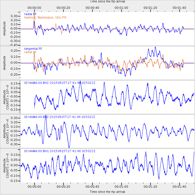
HAWA Hanford, Washington, USA - Earthquake Result Viewer
*The percent match for this event was below the threshold and hence no stack was calculated.
| Earthquake location: |
Kermadec Islands Region |
| Earthquake latitude/longitude: |
-27.3/-176.3 |
| Earthquake time(UTC): |
2015/08/15 (227) 17:29:23 GMT |
| Earthquake Depth: |
21 km |
| Earthquake Magnitude: |
5.5 MW |
| Earthquake Catalog/Contributor: |
ISC/ISC |
|
| Network: |
US United States National Seismic Network |
| Station: |
HAWA Hanford, Washington, USA |
| Lat/Lon: |
46.39 N/119.53 W |
| Elevation: |
364 m |
|
| Distance: |
89.5 deg |
| Az: |
35.356 deg |
| Baz: |
228.094 deg |
| Ray Param: |
$rayparam |
*The percent match for this event was below the threshold and hence was not used in the summary stack. |
|
| Radial Match: |
58.765877 % |
| Radial Bump: |
400 |
| Transverse Match: |
44.81439 % |
| Transverse Bump: |
400 |
| SOD ConfigId: |
7422571 |
| Insert Time: |
2019-04-20 11:21:24.487 +0000 |
| GWidth: |
2.5 |
| Max Bumps: |
400 |
| Tol: |
0.001 |
|
Signal To Noise
| Channel | StoN | STA | LTA |
| US:HAWA:00:BHZ:20150815T17:41:46.925022Z | 0.820357 | 6.7684574E-8 | 8.250623E-8 |
| US:HAWA:00:BH1:20150815T17:41:46.925022Z | 1.8159925 | 8.7277854E-8 | 4.806069E-8 |
| US:HAWA:00:BH2:20150815T17:41:46.925022Z | 1.758616 | 1.0530572E-7 | 5.987989E-8 |
| Arrivals |
| Ps | |
| PpPs | |
| PsPs/PpSs | |


