You are here: Home > Network List > UW - Pacific Northwest Regional Seismic Network Stations List
> Station HOOD Mt Hood Meadows, OR CREST BB SMO > Earthquake Result Viewer
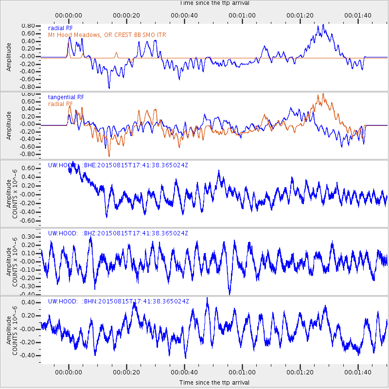
HOOD Mt Hood Meadows, OR CREST BB SMO - Earthquake Result Viewer
*The percent match for this event was below the threshold and hence no stack was calculated.
| Earthquake location: |
Kermadec Islands Region |
| Earthquake latitude/longitude: |
-27.3/-176.3 |
| Earthquake time(UTC): |
2015/08/15 (227) 17:29:23 GMT |
| Earthquake Depth: |
21 km |
| Earthquake Magnitude: |
5.5 MW |
| Earthquake Catalog/Contributor: |
ISC/ISC |
|
| Network: |
UW Pacific Northwest Regional Seismic Network |
| Station: |
HOOD Mt Hood Meadows, OR CREST BB SMO |
| Lat/Lon: |
45.32 N/121.65 W |
| Elevation: |
1520 m |
|
| Distance: |
87.7 deg |
| Az: |
35.139 deg |
| Baz: |
226.572 deg |
| Ray Param: |
$rayparam |
*The percent match for this event was below the threshold and hence was not used in the summary stack. |
|
| Radial Match: |
40.91395 % |
| Radial Bump: |
400 |
| Transverse Match: |
61.06039 % |
| Transverse Bump: |
400 |
| SOD ConfigId: |
7422571 |
| Insert Time: |
2019-04-20 11:21:32.167 +0000 |
| GWidth: |
2.5 |
| Max Bumps: |
400 |
| Tol: |
0.001 |
|
Signal To Noise
| Channel | StoN | STA | LTA |
| UW:HOOD: :BHZ:20150815T17:41:38.365024Z | 1.3591468 | 1.1429158E-7 | 8.4090686E-8 |
| UW:HOOD: :BHN:20150815T17:41:38.365024Z | 2.045862 | 2.58347E-7 | 1.2627783E-7 |
| UW:HOOD: :BHE:20150815T17:41:38.365024Z | 0.82982814 | 2.507534E-7 | 3.021751E-7 |
| Arrivals |
| Ps | |
| PpPs | |
| PsPs/PpSs | |


