You are here: Home > Network List > UW - Pacific Northwest Regional Seismic Network Stations List
> Station UMAT Pilot Rock, OR, USA > Earthquake Result Viewer
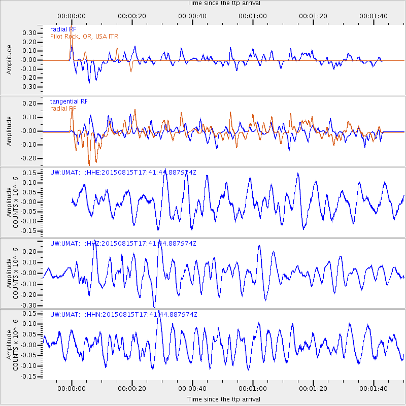
UMAT Pilot Rock, OR, USA - Earthquake Result Viewer
*The percent match for this event was below the threshold and hence no stack was calculated.
| Earthquake location: |
Kermadec Islands Region |
| Earthquake latitude/longitude: |
-27.3/-176.3 |
| Earthquake time(UTC): |
2015/08/15 (227) 17:29:23 GMT |
| Earthquake Depth: |
21 km |
| Earthquake Magnitude: |
5.5 MW |
| Earthquake Catalog/Contributor: |
ISC/ISC |
|
| Network: |
UW Pacific Northwest Regional Seismic Network |
| Station: |
UMAT Pilot Rock, OR, USA |
| Lat/Lon: |
45.29 N/118.96 W |
| Elevation: |
1318 m |
|
| Distance: |
89.0 deg |
| Az: |
36.445 deg |
| Baz: |
228.519 deg |
| Ray Param: |
$rayparam |
*The percent match for this event was below the threshold and hence was not used in the summary stack. |
|
| Radial Match: |
45.38307 % |
| Radial Bump: |
400 |
| Transverse Match: |
45.268074 % |
| Transverse Bump: |
400 |
| SOD ConfigId: |
7422571 |
| Insert Time: |
2019-04-20 11:21:36.608 +0000 |
| GWidth: |
2.5 |
| Max Bumps: |
400 |
| Tol: |
0.001 |
|
Signal To Noise
| Channel | StoN | STA | LTA |
| UW:UMAT: :HHZ:20150815T17:41:44.887974Z | 1.0094273 | 5.6465993E-8 | 5.593864E-8 |
| UW:UMAT: :HHN:20150815T17:41:44.887974Z | 0.9899926 | 4.2996554E-8 | 4.3431186E-8 |
| UW:UMAT: :HHE:20150815T17:41:44.887974Z | 2.0082073 | 9.228372E-8 | 4.5953286E-8 |
| Arrivals |
| Ps | |
| PpPs | |
| PsPs/PpSs | |


